|
Reflections 2014
Series 16
October 7
Canada Redux I : Rideau Canal, Kingston to Ottawa – Carleton University
| | Canada Redux? How can that be? Even after many earlier visits over the years, didn't we just go to Churchill in October 2011 ("North Coast")? To Saguenay, Ottawa, and Quebec in September 2012 ("Canadian Trio")? Newfoundland and Labrador in June 2013 (the last of the "Atlantic Isles")? Have they put a revolving door at the border? | | | | Well, maybe they should, but it needs to be pointed out that this trip started as an extension of that very same Ottawa trip in September 2012, when I fell in love with the Rideau Canal (2013/3). I decided I HAD to ride its length, and beyond that, I had to ride the flight of eight Ottawa locks into the Ottawa River. Shortly after getting home from Ottawa, I checked online about companies that do that, and I found one, and only one: Ontario Waterways Cruises, whose ship is the Kawartha Voyageur. | | | | When I contacted them, I learned about two very interesting limitations, at least from my point of view. They do do canal cruises the length of the Rideau between Kingston and Ottawa regularly throughout the season, which take five nights, but those do not go down the flight of Ottawa locks. They explain this by saying they want to get twelve cruises in per season and there isn't enough time to do six-night cruises, so they don't even enter downtown Ottawa, let along go down the flight of Ottawa Locks. However, the schedule always works out that the very first trip of the season in May, which is northbound, has an odd night left over, so that is used to extend that trip, and that trip only, by one night, allowing the ship to go up and down the Ottawa Locks, including a short ride on the river to see the falls. Furthermore, that six-night trip costs the same as the five-night ones, so it's always popular for that reason as well. They call this lengthened trip their "Spring Plus Cruise". | | | | The second limitation came up when I asked about single cabins, since the 75% single-use surcharge for solo travelers using a double cabin was nothing I wanted to do. Yes, there was a single cabin. Just one. | | | | So for me to play the game as I wanted it, I needed one specific cabin on one specific cruise, and at that point, it wasn't available for the next year, May 2013—and that would have been a little too soon to revisit Ottawa again, anyway. So I told her to start a waiting list for May 2014, and, months later, she contacted me that I could have it for then. | | | | So it was back to Canada again. But that would cover just one week, and I travel for longer periods, so where else? I'd been to all the provinces, and the Yukon as well, some of them several times. The first thing I checked is to see if the suspended Chaleur, the rail route from Montréal to the Gaspé peninsula, had been started up again. I'd been there twice by car, and still wanted to do it by train, but that may end up a permanent loss, because it's still not running. So I decided instead to once again take the Ocean, from Montréal to Halifax, and revisit Nova Scotia again, and Prince Edward Island again to boot. There were a lot of places there I wanted to revisit after many years, which turned out excellently. Finally, rather than backtracking by rail, I'd fly from Halifax back to New York, the only flight of the trip. And so we have Canada Redux. | | | | By Rail to Kingston The Rideau cruise left for Ottawa from Kingston, Ontario, which you can find on this map of the Québec-Windsor Corridor (Map by Vidioman [sic]). Any way you look at it, Lake Ontario was in my way. I had two rail choices from New York into Canada. I could have taken the Adirondack from New York due north via Albany to Montréal, spent the night, then took a day train southwest to Kingston. But I'd taken that train most recently of all, and I'd be in Montréal anyway later, on my way to Halifax. It wasn't as recently that I'd taken the Maple Leaf, so that was my choice. From New York it turns west at Albany to Buffalo and Niagara Falls, NY, then crosses the international border over the Niagara gorge, to Niagara Falls ON. As usual, we passengers alighted there with our bags for a customs check in the station, while train crews changed to a Canadian crew. | | | | When we reboarded, we were officially a VIA train, and went around the familiar western side of Lake Ontario known as the Golden Horseshoe, via Saint Catherine's and Hamilton (see map) for an evening arrival in Toronto. Just as I did on the Churchill trip in 2011, I walked a couple of blocks away to the Novotel Toronto Centre for the night. Always enjoying keeping travel low-key, I'd planned on picking up a sandwich at the food court in the station. I enjoyed the turkey and brie on a homemade baguette in my room so much, that I bought another one for breakfast the next morning, even though it's not exactly meant for breakfast fare. I then boarded a VIA day train to Kingston (see map), which lies at the exit of Lake Ontario (and all of the Great Lakes) into the beginning of the Saint Lawrence River. This strategic location, by the way, is the historical significance of Kingston as a British military garrison during the War of 1812. You can also visualize on the map where the Rideau Canal lies between Kingston and Ottawa, plus the rail connection from Ottawa to Montréal and on down the Saint Lawrence. | | | | Devotees of long-haul automobile driving could have made this connection via a diagonal route in one full day of driving, and would have saved the overnight in the hotel. I, on the other hand, spent a day plus a morning on trains, writing, snacking, and enjoying the scenery, arriving refreshed in Kingston. I prefer my way. No long-haul drives, no car needed for the first part of the trip, and a rental car only on arrival later in Nova Scotia. | | | | Quick Review of Canal History This is a quick review of the history in 2013/2 about why the Rideau Canal was built. Much is new, but some is excerpted from that writeup so that I don't reinvent the wheel. Copy and paste this link showing a map of the geographic "triangle" involved (adjust the plus sign at the top to make the map comfortable size):
http://www.ottawatourism.ca/images/stories/pdfs/travelinfo/EasternONmap.pdf
| | | | When everything in sight here consisted of British colonies, there was no problem, but once the American Revolution had taken place in the late 18C, an international border suddenly appeared starting at the outlet to Lake Erie at Kingston and encompassing a considerable stretch of the upper Saint Lawrence River to beyond Cornwall, on the way to Montréal. North of that line was still British North America (which became Canada) and south of it was the United States, specifically the northern border of New York State. Both commercial and military British shipping needed the Upper Saint Lawrence to connect the Great Lakes and the British Naval Base at Kingston with the settlements on the lower Saint Lawrence (Montréal, Québec) as well as with the ocean and Britain, and the river was now vulnerable. During the War of 1812 there had been military incursions north of this border by the US, and it was felt that shipping had to be protected in the future, needlessly, as it turned out. | | | | But there was a geographic curiosity that could solve the problem and create a detour for shipping around the "danger spot". On the right of the map can be seen where the Ottawa River flows into the Saint Lawrence. This was perfectly navigable up to Chaudière Falls, which is why Hull (today Gatineau) had been founded there, to make use of water power for lumbering. Roughly across from Hull/Gatineau, the Rideau River entered the Ottawa over the Rideau Falls, named in French rideau (curtain) earlier by Champlain because the falls looked like a curtain of water. If those falls could be avoided, the valley of the northeast-flowing Rideau River led down to an area of lakes, and beyond that was the southwest-flowing Cataraqui River to Kingston. If a canal were built here, it plus the Ottawa River could form two legs of a triangle that avoided the hypotenuse of the Saint Lawrence and potential gunfire onto British shipping. | | | | The War of 1812 lasted until 1815, and just over a decade later, canal construction began in 1826, and lasted six years, until 1832. Construction was supervised by Lieutenant-Colonel John By of the Royal Engineers. But the biggest irony of all is that the canal was never, ever used for its intended purpose, to avoid military attack, since no hostilities with the US ever erupted after the War of 1812. But the canal did serve a commercial purpose for a number of years because the Saint Lawrence used to have a series of rapids in the stretch the detour avoided, so the canal was easier to navigate, making it a busy commercial artery. It also played a role in the early development of Canada, since it was the main route for immigrants going west into Upper Canada (Ontario) and for natural resources such as lumber, grain, and minerals to go east. But this heyday of the Rideau Canal lasted for only about 17 years, because by 1849, the rapids had been tamed by a series of locks on the Saint Lawrence, and shippers moved back to the more direct route. | | | | Today, the Rideau Canal is operated by Parks Canada as a recreational waterway, with the locks open for navigation from mid-May to mid-October. In 2007, it was registered as a UNESCO World Heritage Site, recognizing it as an extensive, well-preserved, significant work of human creative genius, and particularly one that reflects the military history of North America. It is the only canal dating from the early 19C canal-building era in North America that remains operational along its original route, with most of its original structures intact. | | | | Because the canal opens for navigation in mid-May is why my "first cruise of the season" left Kingston on a briskly cool 17 May this year. On this map, you can see the waterways through which the canal runs between Kingston and Ottawa. It's largely forested with only a few towns. Shown on the map are three memorable towns where we stopped, Smith's Falls, Merrickville, and Manotick, and we'll have stories about each of these, and others. | | | | Kingston Serendipity is a wonderful thing. I didn't expect much of Kingston—just a place to get on the ship. Michelin Canada did give it two stars but there was little specific that I wanted to see. In any case, even though boarding of the ship wasn't until 8 PM. I got into town from Toronto right after noon, and thought I could have a relaxing day with little to do or see. It turned out to be one of the more pleasant days of the trip. | | | | The VIA station in Kingston is not downtown but in the northern suburbs, which got me wondering. Post-research has now shown me why there was nevertheless an old, pleasant station that I visited, now used as a Visitor Center, in Confederation Park on the waterfront opposite City Hall. It turns out that that had once been called the Inner Station, and had been the terminus of a small north-south line, now defunct. The main east-west line, originally the Grand Trunk Railway, later CN, had had a station called the Outer Station (1855) on the main east-west line that had always run north of town, and originally required a connection to town by stagecoach of 4.8 km (3 mi). (!) That station lasted until 1974 when modern consolidation of rail lines was taking place. The Outer Station was abandoned, and the present station was built. Doing so allowed the railroad to move its track further north still, avoiding an awkward curve that had been an attempt to bring the line closer to town. To visualize Kingston's layout and the location of these stations, copy and paste this map:
http://www.scottbatsonfinancial.ca/scottbatson/images/map.gif
| | | | Downtown Kingston, with the former Inner Station, is on the Cataraqui River at the lower right, where the blue lines merge. The present, modern VIA station, dating from 1974, is immediately to the right of the bend of Princess Street, where it turns to run downtown. Note the gray road that continues east from that bend. Just south of where it would meet the river was the former Outer Station. You can tell why it was never convenient to run an east-west line way into Kingston, and how even the old Outer Station was a concession to get in just a little closer. But the route has now been straightened, and the present station was located further west along the line. | | | | Only once the train arrived did I notice it was due to be split. There was a diesel engine up front, then a few cars, then another diesel engine in the middle, then a few more cars including mine. The explanation can be found on the map of the VIA Rail Corridor (Map by Airodyssey & MammothStrider). While the corridor runs from Windsor to Québec, we had connected on that blue line from Niagara Falls ON to Toronto. The train out of Toronto was the purple-and-green line, and I got off in Kingston. Once it reached Brockville, the train would split and part would continue "green" to Montréal and part would continue "purple" via Smith's Falls on the canal to Ottawa. This is not something one always sees done, and it was fun to know that that was what was going to happen. | | | | But I got off with many others at the contemporary-style Kingston Station (Photo by Michael Nugent), which, as can be clearly seen from the greenery and extensive parking, is quite suburban in nature. From here, I had planned my route downtown in advance, which was quite simple. There were a few taxis, which I as ever, avoided. There is a bus route that comes up to the station, but runs less frequently than the bus I wanted. Instead, I walked with my wheeled bag a few minutes up to Princess Street, which had already passed its bend and crossed over the rail line on an overpass, and made my way to the enclosed bus stop leading downtown. I now find out that this was the Kingston neighborhood of Cataraqui, of all things, just like the river. | | | | I had a chat with a lady who was also waiting. Google Maps had given me the number of a bus I should take, but this lady checked with the driver of her bus and leaned back out and told me this goes there, too, which was very nice of her. Then the 15-minute ride on the bus led me through the centuries along its low-rise route. | | | | Just like in most cities, we started on a section of Princess Street that was nice enough, but part of the 20C-21C automobile age: strip malls, and parking lots in front of everything. It was the same as everywhere. After a few minutes, the street narrowed and we were in the late 19C, an area of rambling Victorian frame houses. Finally, we were downtown at the last stop, had entered the early 19C, and most of the attractive, sturdy buildings were of stone, to be specific, limestone. I had arrived in what I only later was nicknamed Limestone City. | | | | It was a very sunny, but brisk and somewhat windy day. You wanted to raise your jacket collar as you walked through the streets. But the buildings on Princess Street, the main retail street of downtown Kingston, looked charming. Most were low-rise and of limestone. They were regular shops, bakeries, restaurants. The bright sunshine gave a golden aura to the gray limestone. It was just charming as I just walked around soaking up the atmosphere. | | | | None other than our old friend from Québec, Louis de Buade de Frontenac, Governor of New France, established, here in the town of Cataraqui, Fort Cataraqui later called Fort Frontenac, in 1673. It served as a trading post with the local native population. Over a century later, in 1783, large numbers of Loyalist refugees fleeing the American Revolution came here to settle, many sailing from New York and up the Saint Lawrence—and of course, New York State is just across the river. The town's name was changed from Cataraqui to Kingston in 1788. Although I don't know it as a fact, it would seem likely that that was connected to the Loyalists arriving and wanting to emphasize their loyalty. Located midway between Toronto and Montréal, Kingston was named the first capital of the united Canadas, and the first meeting of its Parliament was held in 1841. But it remained capital for only three years, 1841 to 1844, when the capital was moved to Montréal. Kingston never again achieved the prominence that it had had. | | | | But why is Kingston called the Limestone City? Why are there so many heritage buildings constructed using local limestone? That's all connected with my reason for being in town in the first place. Between 1826 and 1832, the Rideau Canal was built with Kingston as one terminus. Most of the construction of locks and dams was of local limestone, and stonemasons were brought here to do the work. When the canal was finished, many stonemasons settled locally, the limestone was still available, and the result was the Limestone City I was enjoying walking around in. Cut and paste so you can take a look:
http://www.turkey-visit.com/map/canada/kingston/kingston_map.jpg
| | | | At the bottom is the Saint Lawrence, coming west-to-east out of Lake Erie. At the top is the Cataraqui River, up which we'd be sailing as it turned into the Rideau Canal. In between is Kingston Harbour. Visible from downtown across the water are all the military buildings related to the garrison that used to protect Kingston. I just viewed them from a distance, which satisfied my curiosity. | | | | The pictures we're going to include now will tend to go beyond their subject matter. They're meant to show samples of buildings made of the limestone I was reveling in under the bright sunshine, and which have a historic "limestone" link to the Canal. While we have no pictures of the everyday, vernacular limestone buildings, these others will have to be illustrative. Note Princess Street entering from the northwest and ending at the Harbour near City Hall. This is the last major block of Princess Street between King and Ontario (Photo by Chensiyuan). While you see brick, even some frame construction, there are several instances of limestone, especially the Smith & Robinson Building on the right. Note the open limestone arch. I was even able to locate a view out of that arch, across a carpark to the limestone City Hall (Photo by Disposable Dreams). That treed area behind City Hall is the site of the seasonal farmer's market I browsed through. I understand that the market square in the winter is transformed into an outdoor skating rink. On the map, you'll notice that just beyond is the limestone 1828 Cathedral of St George (Photo by SimonP), which I also stopped to admire. | | | | The map also shows that the front of City Hall (Photo by Andrew MacKinnon) is best viewed from Confederation Park on the shoreline, at the Confederation Basin Marina. The building is in Neoclassical style, and dates from 1844. Its scale and design indicate that it was built to be the Parliament of Canada in the period Kingston was capital (1841-1844), but on its completion, the government had already moved to Montréal, and the building never served its original purpose. The park is a city block in size and was established on the waterfront in 1967 on formerly industrial land and rail yards dating from the time the adjacent ex-Inner Station (Photo by Doug Kerr) was in use, the present Visitor Centre. And yes, it's made of limestone. | | | | When you look out from the Park across the marina, you cannot miss the 1847 limestone Martello Tower (Photo by Taxiarchos228), which I now learn is named the Shoal Tower. It's one of four built to protect both Kingston and the entrance to the Rideau Canal. Of the 16 Martello towers built in Canada, only 11 are still standing, and four of them are in Kingston. | | | | Take one last look at the map. Follow Brock Street out into the harbor and you'll end up walking onto Crawford Wharf, the pier that the ship sailed from, as many others do locally. Just north of that, project Princess Street out this far and you'll come to a former pier containing the Holiday Inn Kingston Waterfront, with its substantial parking lot just north of it. People driving to Kingston for the cruise were told to park there without charge, since there are standing special arrangements with the hotel. Also, we were allowed to check our luggage at the hotel until the evening boarding time, also based on special arrangements. And finally, I can't believe my luck in finding this view to the south (Photo by Timkal). It's apparently taken from the Holiday Inn. City Hall and the Park are to the right. The Martello tower is in the marina. And in the foreground is the very pier we sailed from that evening, Crawford Wharf, with some local excursion boat sidling up to it. | | | | But back to the narrative. From early to mid-afternoon, I walked around this area, with my wheeled bag, watching, relaxing on a park bench, enjoying. Mid-afternoon I went to the Holiday Inn to check my bag and relax in the lobby. But we'd been told that, with a boarding at 8 PM, we'd only be given evening snacks onboard, so I thought it wise to go get myself an early dinner in town. | | | | Chez Piggy I'd checked it out just the night before, from Toronto. Michelin once in a while mentions within its sightseeing venues special places to stay or eat. That's the way I discovered the Tickle Inn in Newfoundland (2013/10). As it happens, it had a special mention on the side for dining in Kingston called Chez Piggy. I had liked the online menu, so that was to become my destination. I walked back up Princess Street, one limestone building after another. I was looking for 68R. 68 turned out to be a fine commercial building, but what was that R all about? Looking around the right side, down a broad passage I came to several craft shops around an open space, and this was 68R (Rear). Inside, I found that this had been the livery stable for the building up front, now also totally restored. Apparently people back then knew how to treat their horses, building them limestone living quarters. Actually, I suppose it just reflected that limestone cut by local stonemasons was the best bet for construction. Unfortunately, their website, www.chezpiggy.com, doesn't include many pictures, but do notice the limestone wall on every page. It's not there by accident. | | | | I spoke with the hostess and waitress about Kingston, limestone, and the quirky name of the restaurant. I liked the restaurant, its atmosphere, service, and food so well that I kidded the hostess that the restaurant wasn't enough to get me to move to Kingston, but it came close. The menu was eclectic, rather gourmet-ish, and the prices weren't bad. I ordered the Vietnamese spring rolls, then steamed mussels, with a delightful local wine. In place of dessert, I asked if they had (Canadian) ice wine, which ended a perfect meal and what turned out to be a perfect visit to Kingston, and quite unexpected. | | | | Southern Ontarians Cruising the canal was a delightful experience. I liked all the people I met, with plenty of good conversation. So do not think of the following commentary as negative. The social situation was just unusual. One expects a variety of people. Instead, I got the most closely associated group of (very nice) people I've ever experienced. I joked that they were "inbred". | | | | The quirkiness started after I got back from Chez Piggy and still had a couple of hours to kill in the hotel lobby until the ship arrived (from a cruise on another canal), where I was in an easy chair doing a crossword puzzle. The woman who turned out was the hostess on the ship, someone I'd never met and who'd never met me, came up to me, looked down with a smile, addressed me by name, and then asked if she'd gotten it right. I looked up from the puzzle with a grin. Could this be an out-of-body experience? There were a lot of people in the lobby, since the hotel was filling up for the night. Others waiting around in and near the hotel were probably going to be passengers, like me. But how could she identify me? She sidestepped the question and welcomed me, saying actual boarding would still occur just before 8, since the ship had to be readied from the last trip. | | | | Just before 8, I went down to the ship, where she was chatting with passengers, several of which seemed to know each other. Then a flurry of people arrived who boarded immediately, since they had been on the ship and were linking two (or more) trips together. After boarding and settling in, we had a meeting in the lounge/dining room. Name tags were given out, one color for repeaters and another for newbies. There were VERY few newbies. There was the full quota of 45 passengers on board, all couples, except for three pairs of women traveling together. And me, the only solo traveler. I'd estimate maybe only eight were newbies. | | | | This became even more obvious, and a little unsettling, when the captain and hostess started review what the routines were, such as the three dinner times and the morning, afternoon, and evening snack times, and most of the audience chanted along with the times given, yeah, yeah. | | | | One expects a mix of people and cultures on board a ship. On the only other canal trip I've taken on Sweden's Göta Kanal in 2006, there was an international flavor. Everything was in both Swedish and English, and German and French was available as needed. People came from all over. On any trip that attracts English speakers, one would expect some from the UK, Australia, maybe New Zealand, certainly the US. I had asked in advance, and was told that about 80% of the passengers came from Ontario, 10% from elsewhere in Canada and about 10% from the US, mostly the Northeast, and they had people from the UK, Australia, and New Zealand on their mailing lists from past trips. | | | | But I quickly could tell no other languages were represented, not even French from Québec. The monolingual nature of the ship was in contrast to the bilingual signs later along the canal, which is run by the Canadian government and must post everything bilingually. But, given just anglophones, there was no one from outside North America at all. And no one was from the US, but me. Well, that's fine with me. I live with Americans, and don't need them with me on trips to feel at home. A trip in Canada with just Canadians is just fine with me. But there was more than that. There was one couple from Fort McMurray in northern Alberta (he worked in oil). Everyone else was from Ontario. And actually, the woman from Alberta was a transplant from Ontario, too. | | | | Well, Ontario is a large province! There's still room for variety! But no, everyone was from Southern Ontario. Let me explain. They are two different worlds (Map by Vidioman [sic]). Southern Ontario is in red, with the green area sometimes included, coming to 14-15% of the province. Southern Ontario is not only the most densely populated region of Canada, it has 94% of the population of Ontario, 12 million vs 733,000. Also, the climates and cultures are different. Southern Ontario is the original part, having been earlier Upper Canada, while northern Ontario was added in 1912. Well, every passenger on the ship was from Southern Ontario except for the Alberta husband. And me. Really, how local can you get? | | | | And there's more. Many of the people on board were not only repeaters, year after year, treating the ship as a summer resort, but they would string together two or more trips into a longer voyage. As a matter of fact, the company awarded any tenth trip free, and one couple on board had a free ride this very trip. I was on this trip to see the Canal, others were vacationing at their regular summer haunt. Frequently, someone would later tell me I was going to enjoy the next stop for whatever reason, simply because they'd done it earlier. | | | | Right that very first evening, during snack time, I began joking with the others that this was an inbred group. Even though some had had a drive of a couple of hours, I kidded that "everyone could walk to the ship!" When I pointed the situation out to the hostess, she said that, because this was the first trip of the season, a lot of local repeaters signed up because you get that extra day free. She also pointed out that they used to have a LOT more people from the US—after all, you can almost see New York State on the other side—but since stricter border crossing requirements were established after Nine Eleven, the US market had really dried up. In addition, they were offering people discounts for any friends that signed up, which of course increased the level of inbreeding. | | | | Still, it was a lot of fun being the odd-man out. Particularly that first night, someone would mention where they were from and everyone else nodded, but I had to ask where that was. I suppose if people mentioned suburban towns in New Jersey, Connecticut, or Long Island, I'd recognize most of them. That's how it was here. | | | | I remember one exchange that first evening. A guy mentioned a theater in what we'll call Town X. I asked him where that was, and he started to say it was a couple of blocks from the river, but I said, no, where's Town X?--Well, that's near Town Y.—Where's that?—Well, the bigger city is Town Z. When I still didn't recognize the name, he laughed and said "Well, it's near Georgian Bay!" I laughed, too, and said "THAT is recognize!" I'm pretty good at geography, and can recognize Windsor, London, Hamilton, Saint Catherine's, and lots of other places in southern Ontario, but not those little towns. It was like being at a family reunion, but not being in the family. | | | | Only at the end of the evening did I realize why the hostess had recognized me in the hotel lobby. My face could have been painted blue, I was that much of the odd-man out. It was a very different and unusual experience that I hadn't expected, but as a lot of fun kidding around about it. | | | | One more story on the subject. The dining room consisted of several long tables that seated eight each. The food was very good, and more like home cooking than gourmet—it was even served family style, and occasionally referred to as farm cooking. The server would roll her hot table up to the end of the table and announce what was being served before she started dishing it up. One morning one of the items she was about to serve sounded something like "pimmel peckon". That news seemed to please everyone, but I didn't get it and asked her to repeat it, yet it sounded the same. Finally, one lady translated for me from the Canadian "It's peameal bacon", which still resulted in a blank look on my part, so she went one step further "It's Canadian bacon", which I finally understood. We all had a good laugh about that. | | | | But of course, I didn't leave it at that. We had good wifi reception on the ship and I looked it up. I certainly know Canadian bacon, also known as back bacon, but what was this variation? I now know that, just as dried corn can be ground into cornmeal, dried (yellow) split peas can be ground into peameal, once more common than it is now. Originally for preservation purposes, the cured and trimmed boneless loin of pork would be rolled in peameal, then sliced, for a nice variation on Canadian bacon, with each slice having a crust on the edge. Preservation no longer being an issue, now it's just done for the taste. Also, since WWII, with peameal scarce, cornmeal is used, and sometimes peameal bacon (Photo by snowpea&bokchoi) is called cornmeal bacon. It's become a very common family favorite and can be bought anywhere. I now also learn that peameal bacon sandwiches, made on a Kaiser roll, are quite common. | | | | I was glad to have learned all that, but the most interesting, given the situation, was that peameal bacon is a specialty of Toronto! (So are the sandwiches.) That's why Southern Ontarians were so familiar with it! I brought this information back to the people at the table and that resulted in further discussion about typical foods, also about the similarity of cross-the-border North American foods. For instance, turkey and stuffing with cranberry sauce, which was served one evening, is just as typical of Canada as of the US. | | | | Kawartha Voyageur To show the home base of Ontario Waterways Cruises and to explain the unusual name of the ship, the Kawartha Voyageur, we have to look a little to the west. Aside from sailing the Rideau Canal, the ship also sails the Trent-Severn Waterway through the Kawartha Lakes. Copy and paste this map:
http://www.canadiancanalsociety.org/maps/detail-trent-severn.gif
| | | | Kingston is off the map to the right. Follow the route of the Trent-Severn Waterway from Port Severn and Big Chute near Lake Huron's large Georgian Bay via the Severn River into Lake Simcoe. Orillia has the company offices of the ship. The next chain of lakes are the Kawartha Lakes, after which the ship is named, with Peterborough being its home port. The route leads via Rice Lake to the Trent River to Trenton on Lake Ontario. This is the area the ship also cruises in, and where it was coming from when it reached Kingston. The company works out of Peterborough and offers a northbound cruise between Big Chute and Peterboro and a southbound one between Peterborough via the Thousand Islands in the Saint Lawrence to Kingston. Both sound interesting. (!!!) Copy and paste this map, which ties the canal region north of Lake Ontario together, so you can see the big picture:
http://web.ncf.ca/jim/misc/canoeing/canoeRoutes.jpg
| | | | The ship itself is possibly the most unusual-looking ship I've been on. Even the hostess said it looked like a shoebox. It doesn't have a standard hull, but a flat bottom, which means it's essentially a barge. Or an oversized houseboat. It's a bit of an ugly duckling having the effect of a swan, and it does really grow on you. | | | | It's a family operation. Lloyd and Helen Ackert retired from farming—hence the farm-style meals--and Lloyd built the boat. As the hostess (their daughter) put it, the boat looks like it was built by someone used to building barns, and that's true. Two of their sons alternate being captain, and their wives run the office. The entire crew is otherwise female, cooks, servers, deckhands, and all. I asked about that the first night, and they said there are very close living quarters (which we later got to inspect), and it works out best that way. | | | | The ship was built in 1983 for 24 passengers, in 1995 extended to 38, and in 2000 to its present 45. Its length is 36.6 m (120 ft), its beam (width) is 6.7 m (22 ft), and its draft (depth in the water) is 1.2 m (4 ft). So it doesn't require much depth in the canal, and otherwise is shaped like an oversized shoebox, but that is so it fits into the locks. Generally, though, the Kawartha Voyageur is the largest vessel navigating the narrow waterways of southern Ontario. | | | | Let's see some views of the ship, although most of the stills were taken on the Trent-Severn. We'll start with a rear view (Photo by Robert Taylor), since that emphasizes her signature boxiness, most notable in the stern. You can see that she doesn't sit too deep in the water. There's a back door on either side, but we only used it once. It leads to a work area and the four showers. The rest of the lower deck is cabins. The upper deck has crew quarters in the rear, then the galley, then the dining room, with the lounge up front. The sun deck has mechanicals in the back, behind the sun roof, then a sitting area with the wheelhouse upfront. | | | | Four things on the ship collapse automatically when necessary, such as for low bridges, three of them up top. Most frequently collapsed up top is that arched white communications bar above the wheelhouse, which drops forward like a slipped tiara when necessary. Second most often collapsed is the sun roof. You can see how its supports lean already. For the third thing up top that collapses, let's look at this front view (Photo by Robert Taylor). You can still see the sun roof and antenna "tiara". You see the wheelhouse. Passengers can enter it from the side and have a chat with the captain when he's not maneuvering in a lock. In the back is his bed. But notice how the upper section with windows fits over the bottom. When REALLY necessary—I saw it just once—the wheelhouse collapses down on itself. How does the captain steer? Believe it or not, there's a skylight he opens so he can continue standing and steering as the wheelhouse collapses! But he'd still better duck when he has to! | | | | The fourth collapsible is not up top. It's in the water! When room is going to be needed in an upcoming lock, and announcement is made, passengers clear off the blue bow with that railing so nice and close to water level, a deckhand stacks the chairs near the doorway—believe it or not, the main entrance ("grand entrance?") to the ship—and the whole bow lifts up out of the water reaching close to the back wall, looking like a pug nose. This REALLY gives the ship a rectangular footprint—but that's often useful in a rectangular lock, and sometimes necessary. | | | | But the bow doesn't always need collapsing, as can be seen here where passengers have remained on the bow, under the awning (Photo by Robert Taylor), as the ship exits a lock. Finally, here the sun roof and tiara are collapsed (Photo by Robert Taylor), but not the others. | | | | I want to show a deck plan, but it has to be accessed via the website, which you may want to browse, anyway: http://www.ontariowaterwaycruises.com/
Click on "About Us" and then "The Ship". Click to enlarge the deck plan.
| | | | Enter the ship as I did that first evening, via the door from the "hinged bow". All cabins are outside cabins, mostly with two beds perpendicular to the window wall (as you saw from the outside, these are not portholes, but windows). You can easily find my very cozy single cabin, #7, since it's made small because of the staircase. I liked having my bed parallel to the window. There's an elevator (slow) to the upper deck, but not to the sun deck. You see the four showers (very good ones) at the rear. The cabins are barn-builder basic, but very comfortable. There are open wooden shelves and pipe racks for hanging clothes. Passengers care for their own cabins, and there's a strict no-tipping policy. Walk up the stairs next to my room, and you'll be in the lounge, with its library. The open-seating, single seating, dining room follows, and then the crew area, including where all breads and pastries are baked on board (fresh muffins every morning for snacktime). The whole atmosphere is country-cabin with farm-fresh, farm-style cooking, and is very enjoyable. | | | | We have three YouTube videos of the Kawartha Voyageur:
This runs only 1:05 and is a quick pass-by with music. Nothing on board is collapsed. I don't know where it was taken.
This runs 2:16 and shows the ship passing under a low bridge on the Rideau Canal on the way to Ottawa. In the first half, watch the collapsed wheelhouse and tiara slowly come back to life after passing under the bridge. The sunroof will rise later.
This slightly longer one (4:42--you can skim, and skip the end) shows the "pug-nosed" bow raised while navigating the Trent-Severn. It also shows the ship entering a lock, and at 1:10, the workers, one on each side, walking up to manually close the gates. They'll then open valves to let water out of the lock and lower the ship to the level of the water up ahead, then go to the far side and open those gates for the ship to continue. In the other direction, the sequence is reversed, and upper-level water is drained into the lock to raise the ship instead. In a flight of locks (think of a flight of stairs), such as the eight in Ottawa, the locks are back-to-back, and leaving one lock gets you right into another. It's a delightful way to travel, nice and slow. To better picture what happens at a lock, take a look at these drawings (Images by Cmglee). Click to follow an upstream passage of a boat at a lock on the left, and then a downstream passage at the same lock on the right.
| | | | Locks & Sluices In English, a sluice is a channel, often a wooden trough, to send water in a given direction, perhaps away from a mine, or to transport logs. It might be controlled by a sluicegate at the end. While a sluice does involve movement and control of water, it is different from a lock with a lock gate, such as what we just saw. | | | | It's therefore odd that the word for "lock" in all the following languages is instead related to "sluice". This is "lock" in the indicated languages: GE: Schleuse; DU: sluis; SW: sluss; DA/NO: sluse; FR: écluse; SP: esclusa; PO: eclusa; RU: шлюз / shlyuz. (The Russian is assuredly borrowed from German, as so often is the case.) I would say that, since English has both words pertaining to flowing water, "sluice" has been relegated to a limited, specialized meaning. I suppose that the channeling of water into and out of a lock was originally a sluice system, although now its done with pipes and valves, so a connection does seem to be there. That would mean that a lock included a sluice, whereas in other languages just the one word sufficed for the entire mechanism. | | | | "Sluice" is related to "exclude". The versions in all these languages come from a Late Latin word "exclusa" which referred to a barrier to shut out—exclude—water. The word traveled via Old French "escluse" to a mid-14C English "scluse" to its present form in English. It would have evolved similarly in the other languages. | | | | "Lock" in English, from Old English "loc", has always had its present meaning for a device in a door or drawer that created a barrier to entry. But eventually that meaning was extended to a barrier on a river or canal. So while we accurately visualize a lock on a waterway as a device for (vertically) raising and lowering boats, the history of the word shows that it only referred originally to a lock serving as a barrier to the (horizontal) free flow of water. | | | | Cruising the Rideau Canal We were about to start our 202 km (126 mi) trip through 45 locks clustered into 24 lockstations. That included only 19 km (12 mi) of actual canal cuts, which means that all the rest of the route consisted of the two channelized rivers, plus the chain of lakes between them that, to better connect them, had been further flooded by at least one dam that we visited. Copy and paste this map of the Rideau Canal in another window for ready reference. We saw this map before in 2013/2, but can make better use of it now as we sail along. When I first saw map last year it meant little to me, but now I pretty much remember each twist and turn, and we can follow the route together to see how meaningful we can make it for everybody (click to enlarge):
http://www.rideau-info.com/canal/map-waterway.html
| | | | The Kawartha Voyageur spent the first night at Crawford Wharf in Kingston. During breakfast the next morning we pulled out into Kingston Harbour and up the Cataraqui River. The first locks we came to were at Kingston Mills, not very far away, so it was still during breakfast. The lockstation consists of four locks, #46-49, which were built to pass a series of waterfalls in the Cataraqui River. We were on our way "uphill" to the connecting lake area, although the locks, as barriers, had the tendency to form small lakes in the river on the way. | | | | Pictures are available online of many of the locks, and probably all the lockstations that cluster groups of locks. I'll only choose the most interesting ones to show, since—even during the trip—after a while, a lock is a lock is a lock, but do follow on the map. We passed through Lower Brewers Lock, #45, (Photo by D. Gordon E. Robertson) and then Upper Brewers, finally reaching in the late afternoon the place we'd spend the second night, Jones Falls. But there were special plans afoot here before docking. When we reached the flight of Jones Falls Locks, #40-42, (Photo by D. Gordon E. Robertson), the ship first pulled over to the right to a stone docking area along the shore to let us off, at least those of us who wanted the special walk and who hadn't taken it many times. (!!!) While we were walking, the ship passed through the locks and docked at a similar docking area at the upper level for the night, which is where our walk would end. | | | | The walk through woods and past some tiny hotels lasted about 45 minutes, including several stops. The most interesting one was right at the beginning at Jones Falls Dam (Photo by Dennis Nazarenko), a stone-arch dam. We first stopped at a platform giving this view, then the hostess went across the top to a platform on the other side, to show why this is called the Whispering Dam. Because of the stone arch shape, her whispers came across to our side quite audibly. We then crossed the dam to continue our walk, and could see the large lake it was holding back, which we'd sail on the next day. It was hard to judge, but I later read that the dam formed that lake by crossing the gorge of the Cataraqui River. | | | | While the hostess found the whispering theatrics most intriguing, she did point out that the dam was well known and historic, so I looked it up later. Indeed. It was completed in 1832 to tame the rapids and falls of Jones Falls and to hold back 18 m (60 ft) of water. It was built of large sandstone blocks quarried nearby and hauled by oxen to a landing where a scow carried them to the dam site to be shaped there. No mortar was used with the interlocking tapered vertical stones. The blocks were set in a giant horizontal arch, and the water pressure behind the dam pushed the perfectly-dressed blocks together, just like gravity pulls blocks together in a vertical arch. When it was completed in 1832 it was the tallest dam anywhere in North America at 19.5 m (56 ft). The whispering theatrics were fun, but this information I found much more fulfilling. | | | | On this walk there were warning signs in French to be careful about herbe à puce. I'd love to say I figured out by myself what it meant--I'm not sure I would have—but I didn't have to, since, this being a government park in Canada, the sign was bilingual, and above that phrase it said in English to watch out for poison ivy. But I really enjoyed how French says it. You may know that a marché aux puces is a flea market—why fleas I never understood—so poison ivy was compared in French to flea bites. Also, herbe is an example where one language may use one word throughout while another breaks down the uses with more than one word. For instance, in French you use herbes in cooking, lay your picnic blanket down on the herbe, and try to rid your garden of bothersome herbes. But English uses three words to cover that range: you use herbs in cooking, lay your picnic blanket down on the grass, and try to rid your garden of bothersome weeds. So how to explain herbe à puce? Translating it as "flea herbs" would be silly. "Flea grass" is better, but it's not really a grass. So that leaves "flea weed", a vivid description. I think it's better than the English name, since the plant is not really ivy and calling it poison is rather melodramatic. Since this weed hardly occurs outside North America, other languages have to use or translate the English name. I haven't seen the French name used or translated into other languages. | | | | But enjoying the Jones Falls area didn't end there. It was docked next to the Jones Falls Locks that I retain the most pleasant image of the whole trip. Breakfast was at 8 as always—not my time of the day--but I was ready early. Rather than waiting in the lounge that day, I stayed on the lower level and walked out the front door onto the bow, where a woman passenger was already admiring the view. We were docked on the right side, so we were leaning on the railing on the left side. The water was like glass. On the far side of the canal, a forest of huge pine trees came up to the edge, and each one was reflected in the still water—trees pointing up, trees pointing down. It was so still at that early hour, although maybe I heard some birds. Those few peaceful minutes that morning were the most idyllic experience I had on this trip. | | | | At this point we were into the Rideau Lakes. After Davis Lock, we came to Chaffey's Lock, #37 (Photo by D. Gordon E. Robertson), which was significant for me for a couple of reasons. First, friend Jonathan from Pennsylvania had pointed out to me long before I left that as a teenager, he spent several summers at the Opinicon Lodge right at Chaffey's Lock (Opinicon Lake is on the map), so I was already aware of the area. Second, there were two options available for the time the ship was navigating the lock: the hostess took some on a walk to a cemetery, and for those wanting to stay nearby, there's the Lockmaster's House Museum. I did the latter, but first I walked a few minutes behind to museum to see the Lodge. It was a group of buildings out of another era, but unfortunately was going through a change of ownership when I was there and was closed. Its fate remains unclear. I emailed Jonathan that evening that I'd visited his old haunt. It's always nice to have a personal connection to an area. | | | | The name of the lock is actually poignant. Samuel Chaffey and his brother founded mills here (sawmill, grist mill, more) in 1820, and he also settled here. But it was all flooded by the building of the Rideau canal later in that decade. But what goes around comes around, because the house built for the lockmaster is no longer needed. During the canal season, Parks Canada apparently either hires local people or uses its own employees to come and operate the locks, mostly for pleasure craft, plus the Kawartha Voyageur. Perhaps having a lockmaster was more appropriate when steamboats regularly came through. Anyway, it was of interest to tour a 19C house, which also included information about the canal and lock. Afterward, I still had time to watch the ship finish maneuvering within Chaffey's Lock, something we usually watched from on board, and rarely from the shore. | | | | The morning snack, available mid-morning, was often fresh muffins, or perhaps cookies, such as oatmeal or chocolate-chip, and coffee was always available. It might have been here at Chaffey's that I first noticed something rather heartwarming, that kept on occurring at every lock. The lockworkers were having coffee and muffins in the down time between working sets of gates. And later I noticed that it was the captain himself who stepped off the ship with a tray for the workers. It was a nice gesture, especially given all the downtime for the workers between ships in relative isolation. Also, the canal had just opened for the season, so with this first voyage they were setting up a rapport with the lockworkers. Very nice. | | | | It was pointed out that Newboro Lock was the last upbound lock ("uphill") into the lakes. Afterward, we pulled over to visit Westport, the only location I personally felt was a waste of time. It's mostly a shopping stop, with small-town specialty shops for clothing and jewelry, also antiques. I was told the town attracts shoppers from afar, and a lot of people on board—my Southern Ontario colleagues—were happy to be there, so who am I to argue? I amused myself walking around town a bit, but then went back to the ship early, as did many others. However, there were some inveterate hikers onboard that had even come prepared with walking sticks. They must have been some of the regular repeaters because they already knew about the mountain on the north side of town, and they wanted to hike up to the top. Better them than I. But as it turns out, the only picture I've found of Westport online is of a view looking south over the town from atop Foley Mountain (Photo by P199), so we all can see together what those hikers saw. Click to see on the left (east) the little harbor area where the ship docked. The trees, of course are autumnal. (On the southbound trip, the ship stops for the night at Burritt's Rapids, Smiths Falls, Westport, and Jones Falls, the latter being the only one stopped at in both directions.) | | | | I remember being in the wheelhouse talking to the captain when we were approaching Rideau Narrows Lock, #35 (Photo by D. Gordon E. Robertson). Although there's nothing odd about the lock itself, look at the water on either side. There isn't much difference in height, less than a meter/yard. And look at the map. Why would you have a lock in the middle of a lake? While Colonel By logically wanted a single lake, there was so much bedrock that impeded construction that the decision was made to cut off the southern end and maintain it deeper by means of this lock, rather than digging further into the bedrock. | | | | In this last picture, is the view to the north, to the main part of the lake, or to the south, to Upper Rideau Lake? You can tell by the position of the gates. All lock gates, front and back, always point toward the higher water, so that the pressure of water always works to keep them tightly shut. The Upper Lake is deeper, so these gates are pointing toward it. | | | | We have one more YouTube video that fits in right here. It shows the Kawartha Voyageur (with raised bow), as well as smaller pleasure craft, traversing the route from Newboro Lock via Westport to Narrows Lock. It's a sweet collection of mostly still pictures with music. It runs 6:11, but do watch at least the beginning—or skim. | | | | From here on, it's all downbound ("downhill") to Ottawa. We continued crossing the lakes to spend the third night at Poonamalie. This is Poonamalie Lock, #32 (Photo by D. Gordon E. Robertson). The most unusual thing here is the name. Poonamalie (in that spelling), Ontario was named by a worker after Poonamallee (in that spelling), India, who had apparently served there and retained romantic memories of it. I found it on the southeast coast of India near Chennai. | | | | That evening in Poonamalie a local naturalist came on board and gave a talk in the dining room, whose tables had been pushed back. It was followed by the usual evening snacks (pastries, dried fruits). He was very entertaining, and discussed geology, meteorology, and other topics, but spoke mostly about biology, and the fauna found in the area. I would leave it at that, except for a word. At one point he talked about a fisher, and kept on mentioning it. I didn't know what he meant, but had a feeling it was "peameal bacon" all over again. Did everyone else know what animal that was? I checked afterward, and some did, and some didn't. So I looked it up. | | | | It turns out that the fisher he was talking about is a kind of weasel. Its range (Map by Chermundy) covers southern Canada primarily, including where we were, but does extend somewhat south into the US. So actually, it IS mostly a Canadian animal; still, some had never heard of it—not just me. | | | | Leaving Poonamalie, we entered the Rideau River for the first time. While the Cataraqui River had been pretty much obscured by the canal, for much of its distance (not within Kingston, though) the canal often went along the side of the Rideau River, and you could usually tell which was which. There were some dams in the river, and the locks allowed river traffic to pass by the dams, so one usually had a feeling of being both on a river and on a canal. | | | | Midmorning we stopped at Smiths Falls, the larger town we had seen on regional maps early on. It's named after a Thomas Smyth, a Loyalist who settled here in 1786. We all visited the Rideau Canal Visitor Centre located in a recycled 19C mill. There was a lot of canal history, but most interesting for me was a life-size model of part of a 19C canal steamer, which was very evocative of travel at that time. | | | | After a few more locks, we were to spend our fourth night in Merrickville, but arrived in the early afternoon, pulling up to a stone docking area along the shore as we'd had in Jones Falls. However, we were in the very center of downtown Merrickville, which has won an award as the Most Beautiful Village in Canada, and could visit it on our own all afternoon to our heart's content. | | | | The ship was next to a lawn at the former train depot (Photo by Alanadexter), the gray building in the picture in this view of the canal looking upstream. Behind us is a bridge. Copy and paste this map:
http://www.rideau-info.com/canal/history/merrickville-tour/merrickville-walkingtour.gif
| | | | But the ship was facing to the right side of the map, downstream, and here you see the bridge carrying a main street from downtown to the north bank. This map shows particularly well how the Rideau Canal "lives" alongside the Rideau River. The bridge first crosses the canal, then runs along a dam holding back the river, then passes over a spillway to allow excess water to pass, and then reaches the north bank. Our location was literally steps from the Merrickville Blockhouse Museum (Photo by D. Gordon E. Robertson), #1 on the map. A blockhouse is a small, isolated mini-fort in the form of a single building. Four were built along the canal to protect it--we saw the Newboro Blockhouse in the above video. | | | | My first stop was to see the blockhouse interior, where I picked up a self-guided walking tour from the Merrickville Historic Society, which stops at the 22 properties shown on this map out of the 33 "listed" (landmarked) properties in the town, most of them in stone. Click on the last picture again to look behind the blockhouse, also partially in stone, to see some of the stone buildings on Main Street. On the left, you can also see the start of the railing of the bridge, whose walkway is decorated with flowers. I crossed the bridge first to see those properties to the north, and also walked down to the marina on the riverbank, then went to every one of the remaining buildings on the tour, making for an informative and pleasant afternoon. As I've said, I'm an enthusiastic urban walker. | | | | This is the handsome Baldachin Inn (Photo by Kenn Chaplin), stop #6, right at the corner of Main and the bridge that we peeked at to the left of the Blockhouse. It was built c 1862 as the largest commercial building in town. Near it is the c 1861 Samuel Jakes House, stop #7, (Photo by Kenn Chaplin), originally home of a prominent merchant. Here we have more fine stonework (Photo by Kenn Chaplin), in this case on the 1856 Merrickville Town Hall, stop #22. | | | | Leaving Merrickville's locks the next day, we came to two locks that were not adjacent, but still rather close. To be different, most of us got off at the one and walked about 15 minutes to the next one, where we reboarded. (I'm happy to do rural walking within defined destinations like this.) We then cruised downriver to where Long Island split the river in two (see canal map), near Manotick. There is a flight of locks, #14-16, on the right channel at Long Island (Photo by D. Gordon E. Robertson). We then docked for the fifth night at Long Island/Manotick, and, since it was just mid-afternoon, we got off in a picnic area where a rented school bus soon arrived after dropping off kids for the day. It took us onto Long Island and across it into Manotick on the other side to see Watson's Mill and the Dickinson House. | | | | When the canal was built, a village called, appropriately, Long Island Locks formed near those locks in 1833. Finally, in 1859, water rights were obtained and a stone mill (flour mill, sawmill, more) was constructed by a Mr Dickinson across the river, around which Manotick developed. Long Island is represented in the name of the town, which Dickinson named Manotick after the Algonquin word for "island". A Mr Watson bought it in 1946 and it became Watson's Mill, today a working museum and operational grist mill and the iconic symbol of the town. Across from it Dickinson built in 1863 what is now Dickinson House, the first major building in the town beyond the mill. It served as general store, bank, post office, and telegraph office. It was used by the families of the mill owners as their residence from 1870 to 1972. Although I knew we were approaching Ottawa, just 16 km (25 mi) away, I had no idea when I was there that Manotick was amalgamated into Ottawa in 2001 and is now actually a southern suburb—Ottawa still seemed so far away. | | | | We toured the several floors of Watson's Mill (Photo by SimonP), which gave such a 19C feeling of wooden mechanisms inside, and then the Dickinson House. At one point, our hostess was prevailed on to sit down and play a hymn on the upright piano in the living room, which gave a period feeling as well. | | | | The next day it became clearer that we were approaching Ottawa as the shores looked more urban. Let's look again at this satellite view of Ottawa (and Gatineau [Hull]) that we used in the Ottawa writeup. If you'd rather see it in a separate window, use this link:
http://upload.wikimedia.org/wikipedia/commons/3/36/Ottawa_SPOT_1057.jpg
| | | | In this view, all the larger bodies of water have a grayish hue, so find (click) at the bottom center where the Rideau River is lake-like because of the dam up ahead. This is Mooney's Bay and we're at the iconic split of the river and canal. The Rideau River takes off to the east and drops down a series of artificial waterfalls called Hog's Back Falls (Photo by D. Gordon E. Robertson). Technically, the name is Prince of Wales Falls, but no one calls it that. These falls had been a series of rapids from which had protruded a ridge of rocks called the Hog's Back. On the satellite view, follow the river, which now flows to the right of a long narrow peninsula, which then widens to accommodate Carleton University. The river then works its way well to the east of downtown Ottawa to split at the very end to the two parts of Rideau Falls on the Ottawa River. | | | | Now go back to Hog's Back Falls on the map. You can see where the canal takes off at the west side of the dam. This is the location of the Hog's Back Locks, # 11-12 (Photo by D. Gordon E. Robertson). The gates are pointing inward, which is upstream, so we're looking south and the falls are to the left behind the trees. I distinctly remember our being able to see the falls a bit through the trees from the lock, and a lot more of their upward spray. | | | | We then continued with the narrow peninsula on our right, with a hint of the river beyond, until the peninsula widened to the bottom of the triangle where Carleton University (Photo by Kristoferb) is located, as seen in this view from the south (click). The canal is to the left, with Dow's Lake just visible; the river is to the right; Carleton is in the middle; downtown Ottawa is in the distance. | | | | And just beyond that bend in the canal we came to Hartwell's Locks, # 9-10 (Photo by D. Gordon E. Robertson). Given the position of the gates, we're looking downstream (north) towards Ottawa. Given the lock numbers, only Ottawa's flight of eight locks remained. | | | | I learn now that this is another case of a place where no locks were actually planned. Colonel By wanted more locks at Hog's Back, but found once again there'd be less excavation needed by keeping these here instead. So instead of this last, long canal cut running uninterrupted from Hog's Back to the Ottawa flight, this break appeared here. | | | | Note how idyllic this scene is next to the University, on the right. There are bicycle paths here on both sides of the canal, running the length of the entire cut to Hog's Back. Normally, the five-night trips end here, where those returning to Kingston to get their cars (the majority) would be picked up by a bus. This to me seems to be a lack of fulfillment of the trip, not going to the end, even when so close. But our trip had two advantages. I took it for the Ottawa Locks, but we would also get to ride this last bit into Ottawa itself and actually spend our extra sixth night in downtown Ottawa. I'm so glad I got on the six-night trip to be able to complete a downtown Kingston to downtown Ottawa journey. | | | | But keep this scene in mind. I'd be coming back here the next day. Because of train schedules—The Ocean to Halifax runs now only three times a week—I needed to spend the weekend in Ottawa, which was a good chance to relax. Two years earlier, I'd enjoyed staying at McGee's Inn in Sandy Hill, east of downtown, and planning this trip months earlier, I wanted to do it again. But they were booked, and I was warned I'd have a hard time finding anything. As it turned out, this was to be the weekend of the Ottawa Marathon. Who knew? I checked on Kayak and the only availability was at places deep into the suburbs—and I'm a city boy. But there was one interesting possibility. As it turns out, Carleton University rents out its dorm rooms to the general public for the summer, there was availability, and for a very good price—for a suite, no less. So I was to become a college kid again for my time in Ottawa this trip, along with plenty of others, including a lot of marathoners. | | | | Back to the satellite map. I think it's particularly appropriate that on this particular trip, I'd be staying at Carleton, located right between canal and river, where I could visit both. But let's sail north around the top of the university, where Dow's Lake is located, once a swamp, and head on all the way into downtown. In addition to holding the satellite map handy, this regular map may be helpful in another window still, and we can refer to both. On this map as well, locate Carleton, split by the route of the O-Train, and trace both waterways, including Dow Lake up to the Ottawa River:
http://www.mappery.com/maps/Ottawa-Ontario-Tourist-Map-4.jpg
| | | | The canal pictures we used in 2013/3 for downtown Ottawa were ideal, so we'll now reuse them, yet I find a totally different feeling looking at the same pictures, then from a land point of view, and now, from the water level, for a maritime point of view. | | | | We docked on the right side of the canal next to the former rail station, now the Government Conference Centre, called on the map the Centennial Centre. We were between the Mackenzie King Bridge (Photo by Staatenloser), from which this view is taken, and the Plaza Bridge, crossed by Wellington Street (left) and Rideau Street (right), with a view of Parliament on the left and the Château Laurier Hotel on the right. What a perfect location to spend the night! I wouldn't have wanted to have missed it. This is a similar view (Photo by Andrijko Z.), but with less boat traffic. Click to see EXACTLY where we docked behind those two little boats and next to that park. | | | | There is another pleasant, but longish YouTube video (6:10) tracing the end of the route, Hogs Back-Hartwells-Ottawa, but not going down the flight of Ottawa Locks. If you watch it, the tallish buildings at Hartwells are of Carleton University. | | | | Again, it was only mid-afternoon, and we had plenty of time to walk around town. I had already seen two years earlier most of what I wanted, but I had become fully aware of Chaudière Falls only after that visit, so that was my goal today. It had always been an impediment in the Ottawa River, back to the natives and to Champlain. It was the place where Philomon Wright and his settlers came in 1800 to go into lumbering and found what is today Gatineau, of which Colonel By's Bytown (Ottawa) at the north end of the Canal was essentially a southern suburb. I had missed out on seeing the falls and now had another chance. | | | | Not counting some stops I made, it was about a half-hour's walk. I went down the Sparks Street Mall, passed Victoria island with the Portage Bridge (not shown on this older regular map, but visible on the satellite map)—it was named after the original portage trail around the falls and rapids--and crossed onto Chaudière Island and onto today's Chaudière Bridge (Photo by JustSomePics). The area had always been industrial in modern times, but was improving with parkland, yet still looked a little scruffy from the industry, and dusty, since a lot of bridge construction had been going on for repairs. You can see the narrow pedestrian crossings on either side. I crossed over to the left, on the upstream side. | | | | Only now, well after the visit, I once again learn more about the location. There have been a number of bridges at this location, but the very first one goes back to Colonel By! With this, I found more corroboration that Ottawa (Bytown at the start) was a southern suburb of Gatineau (first Wrightsville, then Hull). By's original base of operations for the Rideau Canal had been in Wrightstown (Hull, Gatineau) before being moved to the south bank, and a bridge had been necessary as part of his operations. | | | | Earlier incarnations of the bridge had been called the Union Bridge, since it symbolized the joining of the provinces of Upper Canada (Ontario) and Lower Canada (Québec). Built under By's direction, the first Union Bridge (click to see the vehicle and pedestrians, as well as the original falls) was an eight-span truss bridge that opened in 1828. It was built on masonry foundations, and seven arches were also of masonry, but this illustration shows its main arch, which was made of wood. However, it collapsed in 1836, which started a series of replacement bridges leading up to today's Chaudière Bridge. However—surprise!--several of Colonel By's masonry arches dating from 1828 are still in use, just to the north of the current steel bridge. Fortuitously finding this out now makes it seem to me more than ever that this was just the stop to make in Ottawa after cruising the Rideau Canal. This is another view of the original Chaudière Falls in 1838, ten years after the first bridge was built and before any damming was done. That would be Chaudière Island in the middle, with the main channel on the right, where the main bridge spans have always been. I'd thought there were no bridges shown, but very close inspection (but it doesn't expand) shows an arch on the left and parts of a bridge on the main channel on the right. | | | | Now consider again this aerial view we first saw in 2013/3 of what passes for Chaudière Falls today (Photo by Shanta, from a hot-air balloon). The view is to the east (click), with Parliament in the distance and the exit to the Rideau Canal between it and the Alexandra Bridge. The next day the ship would exit here and I could try to get another view of the falls from river level. Closer is the Portage Bridge crossing Victoria Island on the right, and closest of all is today's Chaudière Bridge, in green, and Chaudière Island, to its right. What passes for the falls today is defined by that arc, which we'll come back to. On both of our maps, note that artificial arc-shaped barrier over which the river is made to fall. | | | | The provincial boundary crosses the bridge and channel and the falls all seem to be officially on the Québec side (see regular map). Finally, midway across the bridge, I had a good view of the falls. From where I was now standing on the bridge (Photo by JustSomePics), as I looked westward, the illusion took over that I was seeing a real waterfall, and not water coming over a barrier. But you do see from the bridge an impressive flood of white water come crashing down before you, appearing as a set of cascades and, OK, a waterfall. The width is about 60 m (200 ft) and the drop is some 15 m (49 ft). I've also since found out that they aren't always so impressive. It was May, and the river was still being affected by the spring rise. It was a fortuitous time to be here. | | | | But click on the last picture and inspect closely what that barrier is. Here's another view of the barrier (Photo by Pierre Tourigny). I now learn that what we're seeing is not a dam at all, it's a four-turbine hydroelectric generating station, two run by Hydro-Ottawa and two by Hydro-Québec. The new term I've just learned is that it's a run-of-the-river generating station—without a dam. In most cases, a dam holds back the river and forms a reservoir, which is then tapped by a generating station in or next to the dam. The reservoir permits operations even when river water is low. But this system is—I'll call it—catch-as-catch-can. It operates intermittently, perhaps seasonally, when the river has a heavy flow, and doesn't operate otherwise with low or no flow, making it an intermittent energy source. This view (Photo by RaynaultM), off to the right-hand side, shows some of the remnants of the industrial area near the power station. The government would like to develop this property into a major tourist attraction. After all, why should I be the only one to visit here? | | | | I battled bridge traffic to cross over to the pedestrian walkway on the downriver side, and this view was almost as impressive, since the churning water was further below me. Compare in the earlier aerial view the still water above the falls—generating station--with the churning Ottawa River beyond the bridge. I was very glad I came out here to see what it's all about. | | | | I walked back in front of Parliament and stopped into the Château Laurier to look at the Karsh photos again, including the scowling Winston Churchill, before returning to the ship. But I'd been told on the ship that I'd be seeing tulips all around Ottawa in this season, and so I did, everywhere, such as here in front of the Peace Tower at Parliament. May was the time of the Canadian Tulip Festival in Ottawa. This is based on the fact that Canada sheltered Princess Juliana of the Netherlands and her daughters in Ottawa for three years during WWII. In 1945, the Dutch royal family sent 100,000 tulip bulbs to Ottawa in gratitude. The Netherlands continues to send 20,000 bulbs annually (10,000 from the royal family and 10,000 from the Dutch Bulb Growers Association). Today, additional ones are purchased from Dutch and Canadian distributors, and over a million tulips are displayed in Ottawa, which claims it to be the world's largest tulip festival. The largest display is on the shores of Dow's Lake (Photo by Eric Bouliane).
| | | | The cruise still had a half-day to go, and the next morning after breakfast, we proceeded straight ahead toward Plaza Bridge (Photo by Padraic Ryan) and then under it. Click to see that it would seem like you're about to sail off the edge of the planet, until you notice the uppermost lock gates, which you enter just like all the others, but with a view down the flight of eight Ottawa Locks, # 1-8 (Photo by Bobak Ha'Eri). We went down "one step at a time" as the views of the buildings kept changing for us. Usually, the lock workers just moved from one lock to the next, and the captain had kept the these workers supplied with coffee and muffins or cookies as well. | | | | Down on the Ottawa River (check the regular and satellite maps), we turned right (downstream) under the Alexandra Bridge for about fifteen minutes or so, seeing the views, including of Rideau Falls (Photo by SimonP), split in two up top by an island in the middle, just as I had walked up to it during the last visit. Then we turned back, and after the Alexandra Bridge I had the presence of mind to look upstream. You had to know what you were looking for, but yes, I could see white water under the bridges, and knew I'd spotted Chaudière Falls from river level in downtown Ottawa. | | | | We then went back to ascend the Ottawa Locks (Photo by Philipp Hienstorfer), gradually moving up again a step at a time. I had always wondered why this spot had been chosen, and found out there had always been sort of a valley or chasm at this point that was then used by the canal builders. I still wonder why, but my best guess is that there had once been a natural river coming down this slope that carved it out—but that's just my own speculation. | | | | It was then lunch time, our last one, and time to say goodbye. By 2:00 everyone was gathered either on the bow or in the park area next to the stone dock, waiting for the buses to arrive. As I describe it, there were three groups. A handful of us were either staying in Ottawa or moving on from here. I was pleased to be in that group. We had used the canal for real transportation, what it was originally meant for. There must also have been some that were staying on board, doing a back-to-back cruise. I think that's second best, but they are making good use of the canal. But the majority were children of the automobile age, who were going by (included) bus back to Kingston to pick up their cars. To my way of thinking, they were negating the trip, canceling it out, relegating it to something trivial, as though it didn't matter. I could never do it—not that I told them--but I'm sure they were happy. | | | | Rideau Canal vs Göta Canal In 2013/7 we listed "Fifty Voyages: 1957-2012". We now have to add the ride on the Kawartha Voyageur on the Rideau Canal as the 51st voyage (Complete, updated list at 2013/7). Not counting the two crossings of the Panama Canal (both westward), since those were just parts of sea voyages, the only other canal I've been on was the Göta Canal coast-to-coast in Sweden (2006/8), which, as I check the list, was #36, in July, 2006. I'd like to compare the two, so copy and paste this link to see its route:
http://www.eurorivercruises.com/images/gotacanal_map.jpg
| | | | Leaving Stockholm, it enters the Baltic, and the canal proper starts when the ship enters the mainland again. This is indicated by the scale at the bottom, showing locks and the lakes that are included in the route. Like the Rideau, there's an uphill segment and a downhill one. Amazingly, both canals opened in the same year, 1832. That trip was on the Juno, a regular hulled ship dating from 1874. This trip was on the barge-like Kawartha Voyageur of 1983. That one had 58 locks, this one 45 (numbered to 49). That one had 54 passengers, this one 45. That one, counting only the canal proper once we re-entered the mainland, was 190 km (118 mi) long, this one 202 km (126 mi). That one took three nights, this one six. Each had a best idyllic moment, both first thing in the morning: cows versus pines. On that trip, it was waking up to the smell of fresh-mown hay one morning, and looking outside, finding cows sitting under the trees so close it seemed you could touch them. On this trip, it was the row of pines at Jones Falls pointing upward and their reflections in the canal pointing downward. | | | | Carleton University Thinking back, the main thing I did in Ottawa this trip was see the falls, but that was off of the ship, and so was part of the cruise. The two-night weekend to me was less centered on Ottawa in general and more centered on living and relaxing at Carleton and traveling out from it in several directions, including finally using the O-Train after discussing it earlier (2013/3). As to destinations, it would be mostly an ethnic culinary weekend, as I'd chosen well in advance somewhere special for dinner on Friday, Saturday, and—in Montréal--Sunday. As is my wont, each destination served ethnic food in a casual, friendly restaurant. | | | | Leaving the ship, I rolled my wheeled bag across Plaza Bridge to Confederation Square. I'd checked out in advance where the bus routes were that I'd need for the weekend, where the stops were, what the fares were—and that you could get a day pass right from the driver—and I got plenty of Canadian change to be able to pay with exact change. With Ottawa lacking a subway system, I was going to make top use of their really quite good bus (and light rail) system. | | | | On our map, the route was roughly west through downtown, then south on Bronson, right to the edge of the campus, at which point bus routes regularly enter the campus to make an internal loop. Again, note the rail line through the campus—that's the O-Train. Copy and paste this map of Carleton University, my weekend home:
http://carleton.ca/parking/wp-content/uploads/parking-map.pdf
| | | | You see the river, canal, and Dow's Lake. Bronson is on the right, and you see the main traffic entrance to the campus from it, and can follow the loop back to the entrance. The red lines are underground tunnels to move about in bad weather. The buses have several stops, and I got off at Residence Commons, #19, registered, and got my room card. Upstairs in this building is the rather nice, very large cafeteria, where the included breakfast was served. | | | | My dorm (Ha! College kid!) was nearby Frontenac House, #41. As you can see, it does have a tunnel entrance in the basement (T), which I saw, but had no reason to use. There is some balance in staying here in Frontenac House, compared to my not having stayed (only dined) in the Château Frontenac (Hotel) in Québec. | | | | The campus architecture is contemporary, nice enough, but nothing special other than one tall building on the Canal, #21 on the map, Dunton Tower (no attribution). Apparently, dorm security is tight. I needed my room card to enter Frontenac House, needed it again to get onto my floor, for the room of course, but then to my room (one of two) in the suite. The suite was comfortable. You entered at one end of the kitchen area, with the bath to your right. The two rooms (the other vacant, as planned for the summer, but still locked) were at the end of the kitchen. When going to the bathroom, I didn't want to get locked out of my room, whose heavy door slammed readily, so for the duration, I propped it open with a barstool from the dining area. The room was large and comfortable, and I was quite satisfied. The only thing I didn't like was that everything in the building was gray concrete, the halls, the walls, everything. It wasn't pleasant to reach out from the bed at night and touch a concrete wall, nor to have gray concrete facing me at the otherwise wooden desk. Good, free wifi, though, and it was a pleasant, comfortable, restful, stay. | | | | I relaxed, and wrote for a while, then was ready to go out. On the Carleton map you can see how short a walk it is from Frontenac to Hartwells Locks, and that was my first stop, and it was very peaceful in the grassy park area there. We'd been there the day before, and this time I was all alone walking all around the area (see earlier picture). There is a former Lockmaster's House there across from the locks, built in the 1840s, which had been built with just one story in stone, but has since had a second story added, and is all in clapboard, hiding the original stonework. | | | | O-Train I was then ready for my two goals, the O-Train and my first ethnic culinary highlight of the weekend. From the locks—check the map--it was just a few steps away from main stop of the O-Train in the middle of campus. You saw on the Ottawa map a rail line cutting north-south through the campus, and, on the campus map, you can see its route set in the middle of the central boulevard. You can see its bridge crossing the river to the south. In the north, that's a tunnel that it goes through under the Canal and west of Dow's Lake. | | | | We can show how the O-Train is a partial resurrection of an old line by using this historical rail map of Ottawa. All the lines in black are abandoned. Most notable among these are the lines, all with dates, converging downtown from the right and running along the canal to the former rail station, which earlier even crossed the Alexandra Bridge to Gatineau (Hull) and beyond. Most important is the light blue line of VIA Rail Canada, coming up at the bottom from Toronto via Kingston (where I got off) and then via Smith's Falls on the canal. It then runs to the newer VIA station at the top of the arc and then continues to Montréal, the route I'd be taking. But of historical interest are the still existing yellow and blue routes, crossing the Ottawa River on a still existing rail bridge and becoming the red route, further extending south to a purple route. Of all of this, the red route has been saved and returned to active passenger use as the light-rail O-Train. | | | | To summarize what we said on the subject in 2013/3, Ottawa originally decided on buses over light rail and built the bus-only transitway across town east-west. However, they were able to build one light rail line as the O-Train, since the right-of-way already existed. But it was then more recently (wisely) decided to convert the bus transitway as a new light rail line called the Confederation Line, which would be further improved by putting the downtown portion of the transitway underground. | | | | Most helpful will be this map of both lines (Map by CptUnconscious). Only the two eventual light-rail lines are shown. In red is the improved Transitway, with the thickened portion the part that will be underground. When I was in Ottawa two years ago, McGee's Inn in Spring Hill was walkable to the University of Ottawa, whose station you see ("Campus"). For later reference when I talk about these (and other, not mapped) routes, note the stations at Rideau, Hurdman, Train (the newer VIA Rail station) and Blair. Work is expected to be completed between 2017 and 2019, so when I used the Transitway on this trip, it still had bus service. | | | | You can now also see that what was red on the earlier map is blue here: the five present stations of the 8 km (5 mi) O-Train, including Carleton. The bus route I took from the ship zig-zagged from the area of the Rideau Street station to the loop around the Carleton O-Train station. | | | | The O-Train was opened in 2001 and had its 10-millionth rider in last 2010. The loopy name was based on the classic Duke Ellington signature tune "Take the 'A' Train", referring to a letter route on the New York subway system. They substituted an O for Ottawa to get "O-Train", a name that had to work in both English and French. As it turns out anyway, it's pronounced just like the French phrase au train ("to the train"). | | | | I have just found out that, once the Confederation Line light rail is completed in the Transitway, the present O-Train line will be renamed the Trillium Line, and the designation "O-Train" will become an umbrella designation for both the Confederation and Trillium Lines. I know a trillium is a flower, but I wondered why that name was chosen. A slight bit of research shows that a white trillium is the official flower of Ontario, and is the emblem and official symbol of the Government of Ontario. | | | | It was built as a single-track line (Map by DavidArthur). Four stations have only single platforms, but Carleton University in the middle has two opposite platforms, so that stop serves as a bypass point for trains in opposite directions. The trains run continuously (but not overnight), end to end, and the timing is such so that the southbound train arrives first at Carleton and moves to the siding with the southbound platform. Once the northbound train has then entered the station, the southbound one is then able to leave. | | | | As the map shows, there are discussions to extend the line two more stops south to the airport, but nothing is planned yet. It would also be possible to extend it north into Gatineau, since the Prince of Wales railway bridge (Photo by Radagast), presently disconnected, does cross the Ottawa River. While Ottawa is interested, Gatineau is not. | | | | Overnight, some freight trains still use the route, which requires a unique adjustment. There are extensions on each of the passenger platforms that are retracted at night, so the freight trains can pass by. | | | | I wanted to ride the entire route, since it's so short, and since I had a day pass anyway. This is the Carleton Station (Photo by Earl Andrew). At the edge of the platform you can see the yellow extenders to ease passenger passage to and from trains, but which can be retracted at night for the passage of freight trains. This view would be looking south from the northbound platform, since the sign points the direction to Bayview in the north. I needed to go north, but started from the opposite platform, because I wanted to go south first to the end of the line. This is a pair of trains in the Carleton station (Photo by Earl Andrew), the only place where two can be at once. The interiors (no attribution) are very railroad-like. | | | | We immediately crossed the Rideau River (no attribution) to the south. This is looking west, toward the rail bridge and Dunton Tower. The ride was short. At Greenboro the train immediately reversed itself. We passed Carleton again, and at Bayview it reversed itself again. I then got off at the Carling Station (Photo by Peter Blanchard), which is in a cut below grade level (platform extenders/retractors visible). | | | | Ethnic Culinary Weekend I went upstairs to Carling Avenue to catch a preplanned bus for a run of about fifteen minutes out to the west for my first ethnic culinary highlight. I'd planned for some time to dine at the Amber Garden Polish Restaurant—and as it turns out, I just made it. When I arrived, I saw farewell signs, as the older couple that had run it for years was retiring—the very following weekend! | | | | I had Polish barszcz
(borscht, borshch), (Photo by Ludek) the traditional beet soup. I had gołąbki / golumpki (Photo by Jacaldinho1) the cabbage rolls we knew at home as Byelorusan/Russian golubtsy. And of course, a portion of pierogi (Photo by Stako), the dumplings. I chatted with the lady as she served me, and when I asked for a typical polish cordial instead of dessert, she sent me over to her husband at the bar, and he suggested a Polish cherry cordial, which completed the meal perfectly. I then took the bus back to Carling and the O-Train one stop "home".
| | | | Saturday was my only full day in town. I got another day pass and took the same zig-zag bus route back to the Rideau Avenue area, and strolled through the Byward Market neighborhood I'd visited last time. I'd never been to the National Gallery of Canada, even with Michelin's three stars. To me, unique places such as Parliament or Rideau Falls are the places I head to, as I did on the last visit. But I had time on my hands, and visited the museum this time. It was a good collection, and I particularly enjoyed the Canadian artists that painted their home landscapes. Still, for me it was the sort of thing to be done on an extra day like this, not a day with more compelling things I wanted to see. After a few hours there, I took the same bus back "home" and relaxed, catching up on writing the China postings I was so far behind on. | | | | As evening approached, I was ready for my second ethnic culinary highlight and took another bus I'd checked out in advance that cut over from Carleton directly to that Hurdman station, where I continued all the way out past the train station to Blair. Right at Blair was the Mongolian Village East (there's another one in the western suburbs). I've enjoyed Mongolian Barbecue for quite some time, fully aware that it's not Mongolian and not barbecue, but Taiwanese stir-fry on a grand scale, invented only in the 1970's. I can quote from memory the three places—now four--I've had it (Vancouver, Apia [Samoa], Taipei). You fill your plate at the buffet with meats, seafood, different kinds of noodles, veggies, sauces, and spices; it's weighed (you pay by weight), and then they stir-fry it on a HUGE griddle-cum-wok, where they do several customers' portions at once. Take a look at this YouTube video of dining on Mongolian Barbecue. | | | | This time I took the bus from Blair all the way down the Transitway to the Bayview stop (Photo by Radagast)—this will eventually be the Confederation Line light rail--then went down below the roadway to the Bayview O-Train Station (Photo by Radagast) back "home". | | | | Sunday after breakfast I checked out and, only needing a single fare, took that same bus via Hurdman to "Train". My VIA train left in the late morning and in a couple of hours I was in Montréal, where I had a layover until the evening, when the overnight train to Halifax left. I was ready for my third ethnic culinary highlight of this weekend, my usual Montreal smoked meat sandwich at Dunn's Famous, a couple of blocks away from the station. This time I didn't order a full smoked meat platter—I don't need French fries—so I could first order some kreplach in chicken soup (Photo by Zlerman), meat-filled dumplings related to Russian pelmeni, Polish (and other) pierogi, Italian ravioli and tortellini, and Chinese wontons. This was then followed by a nice smoked meat on rye (Photo by chensiyuan), similar to pastrami on rye, and a nice cold beer. | | | | I had time at the station, and made my way to the first-class VIA lounge for people taking a sleeper. They had a coffee and juice bar, free wifi, and I spent a few hours getting writing done in preparation to going to Halifax that evening. | | | |
| |
|
|
|


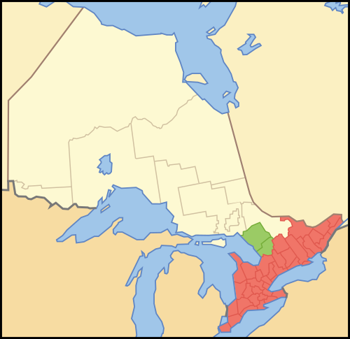
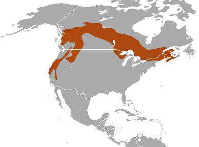
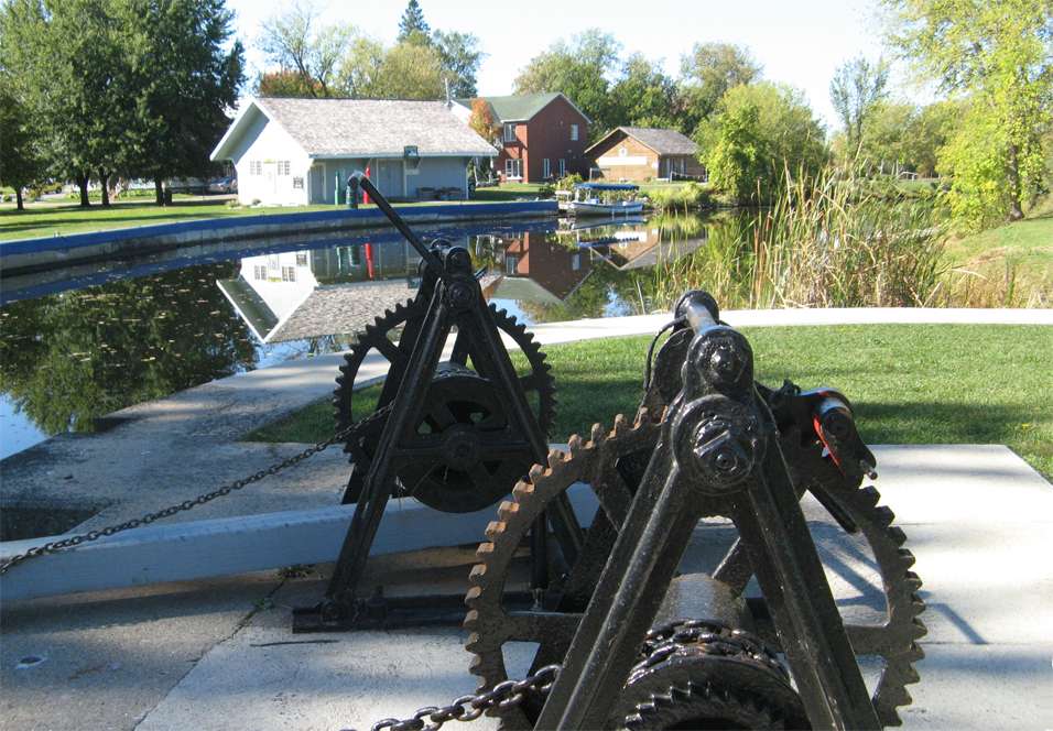
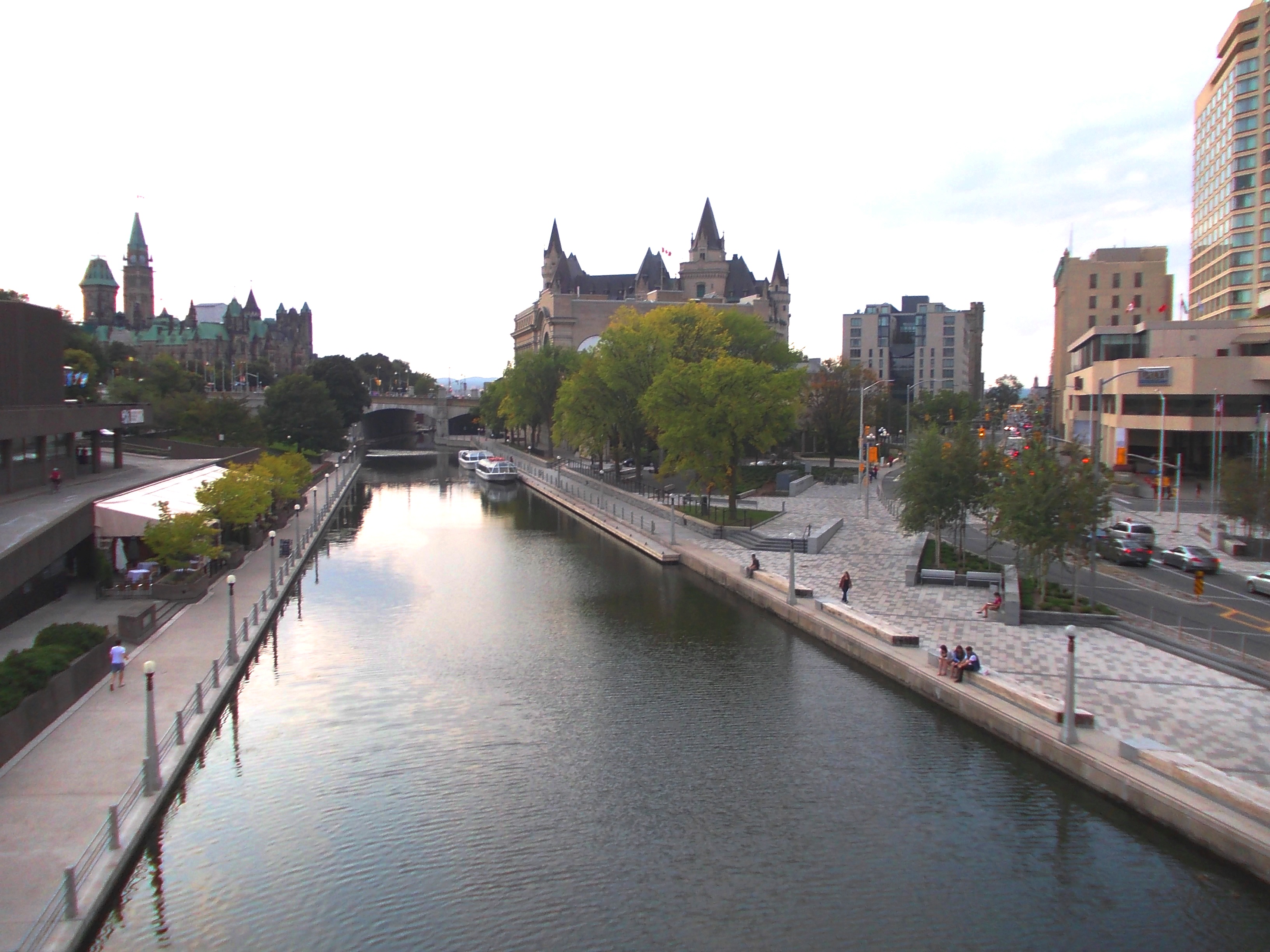
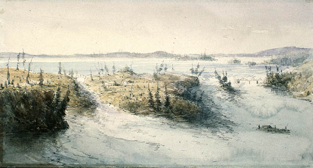
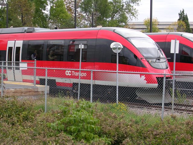
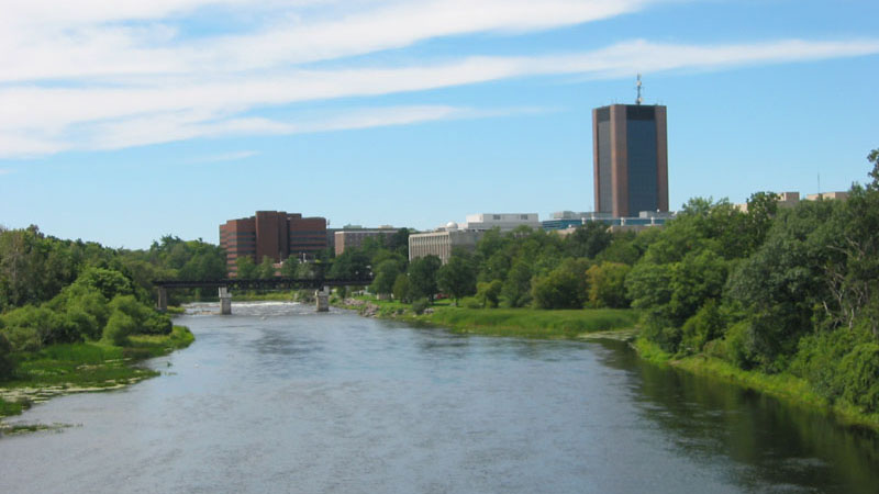
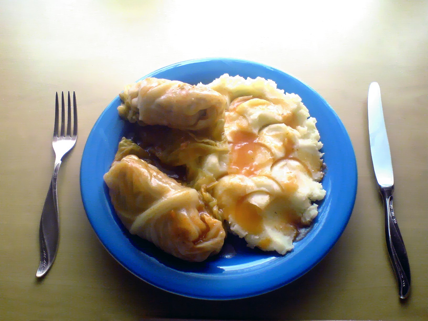