|
Reflections 2013
Series 11
July 10
Atlantic Isles IX b: Newfoundland's "Top of the Rock"
| | This would be my second "real" visit to Newfoundland, not counting the two fleeting experiences mentioned earlier. On that week-long trip in 1984 we had of necessity left out most of the Great Northern Peninsula with L'Anse aux Meadows at its far end due to not having allotted enough time for the drive that far north. That was my major destination this time, to which I decided to add the south coast of Labrador. Both those places were terra incognita, which I would now make terra cognita. I suppose changing terra incognita into terra cognita is something of a lifelong quest. Finally, I thought it would be nice to go back to Saint John's and get to know it a lot better, a ploy that had just served me well with Ottawa and Québec. Actually, revisiting terra cognita definitely has its own charms. | | | | There were three reasons to go north: (1) because we never drove any further north beyond the wreck of the SS Ethie in 1984 and that was something had been left out and was lacking; (2) after doing the Norse research and travel across the Atlantic, this was the logical last place to visit; but also (3) there was the urging of someone else. One day on the Deutschland, I sat down to lunch with David Epstein, who I've kept in touch with, and Mark Pross, the individual who was interested in going to the Eastern Settlement in Greenland, which didn't work out. Mark had been to L'Anse aux Meadows, and urged me to go there. He also was the first one who told me about the rediscovered Basque whaling station in Red Bank on the Labrador side. He urged me to go there, too, but to me, while northern Newfoundland was far, Labrador was Siberia. (Well, actually Siberia isn't "Siberia" any more, either.) At first it was slow finding Labrador information and getting travel data, but all worked out very well. | | | | My flight was to Saint John's, but I had no intention of driving the 1,050 km (652 mi) to Saint Anthony, the larger town at the northern end. It was the long driving distances that foiled going up there in 1984, and I wasn't about to do it now. Google suggests almost 12 hours for that stretch, and I've given up on long-haul non-stop driving. Actually, David Adams of the Tickle Inn, who lives in Saint John's in the off season, does do that long haul in one shot. More power to him. I decided to fly, since the regional airline, Provincial Airlines, the largest in Eastern Canada, had flights to Saint Anthony. It seemed inconvenient to take the ferry to Labrador, so I arranged to continue my PAL flight on to Labrador, and then back to Saint John's. It would then involve three car rentals. Newfoundland is sometimes referred to as "The Rock", and its distant northern tip is the "Top of the Rock", a name very appropriate to my missing out going there in 1984 and my 2013 quest to finally do so. | | | | There was an expensive non-stop from New York to Saint John's, at half-price, I could take Air Canada via Toronto going and via Montréal returning, which is what I chose. Air Canada recently gained a four-star Skytrax rating, and the flights were pleasant. Less so the customs agents. | | | | As a generalization, Canadians have a reputation for being easy-going, but I have not had luck with Canadian customs officials. Crossing by train at Niagara Falls going to Toronto and Churchill I had some friction, crossing by train last September at Rouse's point going to Montréal, I had to convince that woman that my small bag was all the luggage I needed, and it happened again at the Toronto airport. Walking right through the baggage claim with my same small bag to make my connection, one woman agent stopped me to ask why I wasn't picking up luggage. Then, leaving the area, another woman questioned why I was just traveling with a small carry-on, which elicited some friction. She said 80% of travelers have more baggage, and I told her if those people don't know how to travel right—which is light--why should I be questioned as though I'm doing something wrong? Finally, the young man checking passports asked where I was going. I was making three stops in Newfoundland and Labrador. Do you have friends or family there? No. He remained incredulous, as though I might be planning some nefarious activity that would result in the downfall of Canada. We then had a little more friendly repartee, and he agreed that he, too, has traveled to Saint John's to party on George Street, and we parted amicably. In all fairness, it's partly me, because I bristle at anyone questioning why I don't travel in the same manner as others might, both as to finding my own destinations and as to traveling very light. | | | | All Air Canada flights on this trip were pleasant, including these two first ones, and at Saint John's a shuttle took me to the Comfort Inn Airport for the night. The next morning I took the PAL flight to Saint Anthony Airport. It was a smaller prop-jet, half-filled, with 1+2 seating across, and the service was outstanding. It was scheduled at only 1h20, and a few days later, the connection on to Labrador was scheduled for only 0h25 over the Strait of Belle Isle. | | | | Top of the Rock I never thought I'd say so, but after the experience of coming up to the Top of the Rock and visiting Labrador as well, this area stopped being remote and "odd". It's not at all barren, most of it is lush with greenery, the water and sky are as blue as anywhere else (other than on those overcast days). True, it isn't heavily populated, but there are plenty of places less remote that also have low populations. The supermarkets carry everything you need. The roads are good. Icebergs are normal things you see out the window, at least in June and July. It's always a thrill to see one—or ten—isn't it odd how we salivate over clumps of ice in the water—but that's the way of life in this area this season of the year. Newfoundland—and Labrador—have come to mean a lot more to me based on this trip. I have felt very comfortable with the absolute normalcy of the remote north as well as with the rest of the province, including Saint John's. | | | | Let's take another look at our large map of Newfoundland and Labrador (postal designation NL). If you wish to open the map in a separate window for easy reference while reading, copy and paste this link into your browser: www.canada-maps.org/newfoundland-and-labrador-map.htm. Pay special attention to the Great Northern Peninsula as it reaches up along the Strait of Belle Isle, with Labrador on the other side. It's the largest and longest peninsula of the island of Newfoundland, approximately 225 km (140 mi) long and 80 km (50 mi) wide at its widest point. The larger town at its southern end is Deer Lake, where we had left the Trans-Canada Highway that time years ago. With a population of only about 5,000, Deer Lake's airport has major connections across Canada. This is where we turned off in 1984 to see Gros Morne NP. The name means "Great Gloom", but it's a beautiful place, named after a mountain with that name. (I have to force myself to pronounce the S in Gros, according to local custom.) | | | | As reported in the last posting, we had realized in 1984 we couldn't make it all the way up the coastal highway, Route 430, to the northern end at Saint Anthony because of time constraints. But we decided we could drive north a bit for the views, and made it to just beyond Sally's Cove (on the map), which is still within the park. This is where we found the wreck of the SS Ethie right offshore, and over the years, we've used that as a marker of how far north we got. I've now been on the Top of the Rock, and didn't have to drive all that distance. Still I got at the time an excellent idea at the time of how pretty the coastal drive is on a sunny day (Photo by Tango7174). | | | | I have since found out that the wreck of the Ethie is rather well-known, and there are even folk songs about it and its fate. Since it's where my 1984 story on the Great Northern Peninsula left off, I'll pick up from there with the information I've since found out. The Ethie was built as part of the Alphabet Fleet, ships that supplemented the Newfoundland Railroad. The ships were named after places in Scotland, where the railroad's owner was from. The names of these ships went alphabetically up to M, and the first five were Argyle, Bruce, Clyde, Dundee, Ethie. The Ethie was a coastal steamer, similar to those today connecting St Barbe up the coast with Blanc Sablon, in Québec province, unfortunately not named on this map, but maybe 5 km west of the Labrador border. The Ethie was on a run to the south. It had left Cow Head (on the map) when a storm struck, and it went down at Martin's Point, just north of Sally's Cove. All 92 passengers did survive. This is a typical view of the wreckage of the Ethie that one sees (Photo by Tango7174). But this time I could concentrate on the north end of the peninsula without being concerned about the lengthy drive. | | | | "End of the Earth" Few things attract people more then the line where land meets sea. The eye is fascinated, for example, by waves repeatedly hitting the beach, and one stands on seacliffs to be able to "savour the sea". There are also those among us who have a second level of fascination, this being with the spot where one runs out of land, and nothing but sea lies ahead. Forward movement has to halt in order to keep dry. While a logical description for such a place would be the End of the Land, most enjoy a more dramatic name, the End of the Earth. | | | | I am one who goes at great length to reach such points, adding them to an itinerary as often as possible. Ones that come to mind where I have savoured the sea from the edge of the land are, in Europe, Land's End (what a name!) at the southwesternmost corner of England facing the Celtic Sea area of the Atlantic (Land's End had been a lifelong goal); Cabo de São Vicente / Cape Saint Vincent, at the southwesternmost point both of Portugal and of Europe, facing the Atlantic; Skagen, and the northernmost tip of Denmark, facing the Skagerrak (named after Skagen) and the Kattegat; Nordkapp / North Cape, at the northernmost point both of Norway and of Europe, facing the Barents Sea; and the northeasternmost point of Sicily at Torre Faro, facing the Strait of Messina. In Australia, I was sure to go to Cape Leeuwin, the southwesternmost point of the continent. In Hawaii, I went to Ka Lae / South Point, the very southernmost tip of both the Big Island and of the United States, the point where it is believed the Polynesians first reached the islands. In North America, it was the southern tip of Key West island in the Florida Keys; the southern tip of New Jersey at Cape May; the eastern end of New York's Long Island at its South Fork's Montauk Point, and, for good measure, the tip of its North Fork at Orient Point; in Massachusetts, the farthest tip of Cape Cod. Sometimes the pleasure was just a view out to sea, and in other places, it was the pleasure of seeing a clear joining of waters where two currents merged at the point of land. So why wouldn't I go to the End of the Earth at the northernmost point of Newfoundland, surely the most remote angle of its triangular shape? | | | | The Great Northern Peninsula actually leans somewhat northeast, so striving north will also have an easterly component. You'll see on our trusty map that the northern end, the Top of the Rock, is first defined on its south side by the indentation of the large Hare Bay, causing one to turn east at this point, past the other body of water defining it on the north side, Pistolet Bay. Now here's another minor surprise. Saint Anthony Airport, where I arrived from Saint John's, isn't really in Saint Anthony. It's in the middle of nowhere on that road, the same Route 430 coming up from Gros Morne and the Ethie, just about at the beginning of Hare Bay, so it's still a good hour's drive to Saint Anthony. In this way, my arrival by rental car from the airport on 430 seemed in a way a continuation of my drive down below up to the Ethie. | | | | I have two maps for orientation; each shows something different. First we'll have a NASA satellite map of the area. It doesn't start anywhere near the airport to the west, but shows Route 430 afterward passing Pistolet Bay, and running down to Saint Anthony, off the map. Disregard the hard-to-see roads going north for now, because this map is to illustrate the northern points of the peninsula. First let's also disregard the large island on the right, Quirpon Island, named on our main map for the town. Pay attention instead to two central tips of land, where the "Norse Settlement" is somewhat inaccurately mentioned. Note carefully that this Norse historic site faces west, and is on its own bay, while the adjacent outport village of L'Anse aux Meadows is U-shaped and faces north, and is on another bay. So far we have the site and the village. | | | | Now locate the large green peninsula directly opposite it to the left, which we'll see on our main map is the location of Ship Cove. On this satellite map, we can see the cove for Ship Cove facing southeast. The next indentation counterclockwise beyond the point is Onion Cove, facing northeast, and then comes Onion Point, facing north. In sum, here we have two coves and a point. This area turned out to be almost as exciting and informative as the opposite one that I had come here for. | | | | On the previous posting I mentioned David Adams, who runs the Tickle Inn. I am borrowing from his website this map of the area. The Saint Anthony airport is just to the left of where the number 430 appears, so it's a good drive into town. Route 430 ends in Saint Anthony, which you can see is on an indented harbor. It's on the south side, and the outer part of town has a nice view of Iceberg Alley. There are two road junctures. At the first one, Route 436 takes off for L'Anse aux Meadows, and a few kilometers further on, Route 437 takes off, via Raleigh (pronounced like "rally"), to Ship Cove and a short extension goes on to Onion Cove adjoining Cape Onion. David explained to me and the other guests that he remembers as a child there were no roads whatsoever here, and each outport community, with its fishing industry, had to depend on the coastal steamer service that would circumnavigate Newfoundland, which would take days to reach Saint John's. With today's roads and airports, these no longer exist, but I was immediately reminded of a similar experience. To this day, the Hurtigruten coastal steamers still continue up the Norwegian coast from Bergen (and Trondheim, where we got on) all around up to Kirkenes on the Russian border, and back, to unite those Norwegian communities. Apparently that route is still financially worthwhile (and visitors to Norway enjoy using it, too), while those in Newfoundland are no longer needed. | | | | As for the roads, you can consider 45-50 minutes between any and all outlying points, the airport, Saint Anthony, L'Anse aux Meadows, and Onion Cove. You drive on good roads through green forests. I saw a juvenile moose on the roadside on Route 437, a mature female grazing on the roadside on Route 436 near the historic site, and we all at dinner saw two females out the back window of the Tickle Inn, which I referred to as "girls night out". I never saw any bull moose; the only ones I ever saw was when we spotted two crossing the road at Cape Spear near Saint John's in 1984. David explained that moose are not native to Newfoundland. One pair of moose was introduced late in the 19C and two more pair early in the 20C. Today there are more than 100,000 on the island, and all are descended from the six introduced moose. David pointed out that one has to be extra careful driving at night. Once he had occasion to go for a longish drive in the middle of the night and says he saw something like 70 moose along the way. | | | | The Tickle Inn at Cape Onion (on Onion Cove) Coming up from the airport, I turned off Route 437 at Ship Cove and went the last kilometer or two up to Onion Cove. As the road ended right at the beach, the Tickle Inn was on my left, also almost at the water's edge. The house and cove face roughly northeast (where the bay window is), so this view looks roughly north and shows Cape Onion. This angular view from near the water shows both the front and side entrances (all pictures are from David Adams' Tickle Inn website, as was that earlier map). | | | | While we are still outside, let me jump ahead and tell you about the walks. I call myself an urban walker, and don't usually enjoy walking through the woods more than a little bit, but that first afternoon, David encouraged me to take the walk up to Cape Onion. It's a maintained path that starts between the picket fence and the beach, and then rises into the hills. In this picture showing just part of Onion Cove, you can see that the cove is filled with skerries, or small islets. David pointed out to me the narrow channel between two of them (in Newfoundland parlance, a tickle), after which he named the Tickle Inn. He also mentioned that they liked the name since it implies that guests will be "tickled" with the experience of staying at the inn (he's right). Among the skerries in the cove was the occasional small growler of ice, but I saw nothing larger up close. Further off is another story. | | | | As you walk along the path up toward the promontory at Cape Onion and then up it, the first part is on David's land, but open to the public, and then the route enters government land, or as David put it, crown land. Your route varies between a grassy path, a flight of stairs, boardwalks that David has built, and the occasional steep dirt path, until you're up top and have a view. This picture shows the height of the promontory, but is not the best viewpoint. You've reached that when you see the small cairn of rocks on the side of the path, and then you can "see the whole world". You are at the End of the Earth—well, the End of the Land, anyway. It was pleasant enough that I continued walking some distance beyond, to see the view from Cape Onion into the next cove westward. By the way, David's best understanding of the onion reference in Onion Island, slightly to the east, Cape Onion, and Onion Cove, is that the French, who were very active in this area, used Onion Island for the planting of chives, which were apparently easier to grow than onions themselves. | | | | On this nice sunny day, you have an even better view of Labrador across the Strait of Belle Isle than you have from the Inn. Also, you can see some small icebergs from the Inn way out between the skerries, but from the promontory I counted ten icebergs lolling their way along the current. Some of them could have been just bergy bits (growlers would have been too small to see at that distance), but there they were in the sunlight. While they were probably mostly in the middle of the channel, there was an optical illusion that made it seem they were glued to the Labrador coast opposite. I'm not sure where along the trail this picture of icebergs and bergy bits was taken, but they were only occasionally this close in. | | | | While we are still outside, let me jump ahead two days to when I had some extra time after visiting Saint Anthony. When I got back to the Inn, I took the shorter walk eastward to Cemetery Hill. But first do realize the poignant history of Onion Cove, which you see in its entirety here. The Inn is one of the few buildings in the cove today, yet David remembers when it was a busy outport community, filled with houses and with fishing stages at the water's edge. It was the time before the roads, and Cape Onion was considered a "suburb" of Ship Cove, through which its mail came. Then the cod fishing industry declined percipitously, government policy on outports changed, drawing people to larger communities, and Onion Cove shrank. Sophie Bessey, the housekeeper, told me about one man who took his house apart when he left to use the lumber elsewhere, and about some people who dismantled the remaining abandoned and collapsed buildings and abandoned fishing stages to make the cove presentable. Sophie and her husband, who have a contemporary house, maybe 35 years old, behind the Inn, are today the only year-round inhabitants of Onion Cove, present population 2. | | | | Anyway, look at the picture again to see how the path in this direction, along the beach with the skerries and up the hill past the cemetery (in white) leads out to Cemetery Hill Lookout, a walk that takes only about 8-10 minutes one way. From both the cemetery and the point you can look down the other side to the close end of Ship Cove, where there just happened to be an iceberg that day. In the cemetery I was looking at the names on the stones such as Adams and Bessey, when I met a local man, named Bessey, who was tending his mother's grave. We chatted for a while, and then he pointed out something I hadn't realized, and which was very important to me. He pointed out the village of L'Anse aux Meadows on the opposite peninsula where I had been the day before. I just hadn't thought it would be visible across the intervening bay. The village is U-shaped around its cove, and from our angle from the west, it appeared as a white, backwards C. The Norse Historic Site, which would be facing us on its own bay, was too difficult to ascertain. Neither show up on this picture. | | | | However, I was wise enough to identify Belle Isle to the left (north) of the peninsula opposite, which had guided the Norse, and which they had planned to use as a landmark for future arrivals to Vinland. Still, I checked with the man I had met that that was what I was seeing, because Belle Isle looked so much more massive than I had expected. Go back to our main map to see the location of Belle Isle opposite Ship Cove. Belle Isle was named by Jacques Cartier, which then gave its name to the strait. It means "Beautiful Island" in Old French spelling ("island" today is île). The strait has an average width of 18 km (11 mi), so it's easy to look across to Labrador. The island lies on the shortest shipping lane between the Great Lakes and Europe, and also on the main north-south shipping route to Hudson Bay. I was surprised to find out that the island is the northernmost peak, at 213 m (700 ft), of the Appalachian Mountains, whose other end is in Alabama. | | | | The best picture to tell the story of the Inn is the lead picture on their website (which is tickleinn.net). David explains in detail, as does the website, that his great-great grandfather built the forward saltbox section circa 1890, based on which David suspects that this restored building is the oldest home on the Great Northern Peninsula—just think how the rest of the village had disintegrated. He also says it's probably the northernmost dwelling on the island of Newfoundland, although Sophie's newer home next door vies with it for that distinction. Anyway, in 1913, David's grandfather added the perpendicular saltbox on the back of the house (with the side door), and then in 1938, David's father added the lean-to on the far side, all of which are visible in this picture. In some ways, David's contribution, as the fourth generation of the original Adams family, was the greatest, because the house was dilapidated and a total wreck—like the rest of the town—when in 1989 he decided, with help and with a great deal of difficulty, to restore the building and open it as the Tickle Inn. The restoration has won various awards of distinction—you can see one yellow sign saying so in the picture—and is a Registered Heritage Site. The Inn is therefore a genuine and typical outport home, which David also refers to modestly as a "refurbished fisherman's house". | | | | Some hotels are destination hotels, such as Raffles in Singapore. A destination hotel has to have something very special, so that, even if you don't stay there when you visit its city, you might want to stop by and visit it anyway. Usually though, with a destination hotel, expenses are very high. Other than that, I do not need luxe. All I need in a hotel is, after LOCATION!, a place to sleep, and an internet connection. I usually try to stay in modest hotels that meet this criterion of simplicity. | | | | However, for the most part, I'm more comfortable in any case with a Bed & Breakfast than with a hotel. Staying at a B&B is like staying with friends or family. The recent stays I've reported on in Saguenay (Jonquière), Ottawa, and Québec all show this, and with my three B&B stays in NL were just as good if not better. I've even changed my position on shared baths. Years ago, when we couldn't afford anything better, we always looked for shared baths. Then, when our funds were better, they became anathema. But in Québec it worked out well, especially since they supplied a robe, and of my three stays in NL B&B's the Tickle Inn and the B&B in Labrador had shared baths, and the Tickle Inn also supplied a robe. In either case, it worked very well. | | | | That said, I can say that the Tickle Inn, even with its shared baths, is something I didn't think existed, a destination B&B. People do return regularly to it, and, even though I thought this was my last trip to NL, I wouldn't reject such a thought, nor would I reject going back to my B&B in Saint John's, where I was also very comfortable. The Tickle Inn is more than just lodging in historic surroundings, it itself is a travel experience. Since you get to know, usually rather well, all of the guests rotating in and out, and since David hosts the dinner personally at the dining room table, and since everyone does everything together except for going off during the day, I'd almost want to call it semi-communal living, like staying with a large group of friends. | | | | I found the Tickle Inn in Michelin. Not in the red hotel guide—I don't think they do one for NL—but a recommendation for the Tickle Inn appears in a special box next to sightseeing descriptions in the regular green guide. As David's home page says, it's recommended by many guides, but when he heard of my interest in German, he pulled off a bookshelf one of the German Polyglott guides, Polyglott Kanada, which included it among the top 10 hotels, and made the statement that Reisende mit einem Faible für Orte am Ende der Welt sind hier richtig . . ., that is, "Travelers with a weakness for places at the End of the Earth choose well here . . ." | | | | Rates, with breakfast, are amazingly reasonable, particularly in view of the "total experience" one gets here, and a modest statement is made that, for $25, an evening meal can be added. A person would have to be a fool not to include this meal, since the Tickle Inn is listed, and has been consistently recommended, in "Where to Eat in Canada", Canada's national restaurant guide published annually by Oberon Press since 1971, which has sold more than 150,000 copies. And it bears that listing without being a public restaurant, and normally just serving overnight guests. | | | | Standing here in the ample kitchen, the owner-operators of the Tickle Inn are David and Barbara Adams, who come up from Saint John's every year for the season, and Sophie Bessey, on the right, who is the hostess and year-round caretaker, living next door. My only contact with Barbara was by email when I booked, and then by phone when I gave her my credit card number. She was due to arrive the week after I was there. David is a whirlwind, a dynamo, who trained as a biologist, and taught for many years. He knows his NL history forwards and backwards, and has personally experienced much of it, particularly locally. Since I, as usual, had boned up on my destination well in advance, he and I had plenty of discussions about all and sundry, even beyond the general information he gave all guests. It was a pleasant intellectual exercise. | | | | David was off doing chores when I arrived, so it was Sophie who welcomed me to the scent of bread baking in the kitchen. She showed me around the Inn, and brought me to my room. It was on the opposite side of the house from that side entrance, and faced Cape Onion across a meadow, with the sea to the right. Hence it was called the Meadow Room. Does it seem petite? I loved it. To the immediate left in the picture can be seen part of a storage area, and the far right had a desk, perfect for my writing. It had electric heating when needed, and a robe to visit the shared bath(s). Perfect. Even better was the fact that immediately after Sophie brought me to the room, I looked out the window across the meadow—I ALWAYS check out the view first--and saw my first iceberg of 2013 relatively close in to the cove. This was before I took that first walk and saw all the others. I settled in and checked out the three other bedrooms upstairs. There was also a staircase leading to an attic dormitory area, which Sophie explained was for emergency overflow, or for children. Back on my main upstairs level, there were two full baths, each one assigned to a pair of rooms, and a half-bath, just in case. And next to the public computer there were photographs of three ships, and one of them was of the SS Ethie. When I saw that—which I duly reported to David later on—I knew that whatever goes around, comes around, and it symbolized that I'd made a good decision to come back to NL and also to stay at the Tickle Inn. | | | | Downstairs, to the right of the side entrance is the parlo(u)r, facing the sea, and to the left, the dining room. On the far side of the house are the large kitchen and private quarters. | | | | Let me explain what I mean by semi-communal living. Everyone goes off about their business after breakfast, and start coming back in the late afternoon. At 4:00 in the parlo(u)r there's tea and coffee, and home-baked cookies, and usually interesting conversation with those who have gotten back. Over my three nights there, there was a British couple, several Canadians, including a woman and her daughter, and a two women from Michigan traveling together. After tea, one might want a quick nap, or quiet time in one's room, because at 7:30, dinner was served. When I was there, the maximum number of guests was seven, so I don't know about this crowd. But dinner started with homemade soup, David's specialty, with homemade bread. The main course was often cod, with fresh-cooked vegetables. David explained that usually in Newfoundland, cod has been so common that if you say you're having fish for dinner, it automatically means cod. If it's not cod, then you name what it is. A homemade dessert such as berry cobbler followed, with some of the best coffee you could want. David said his secret was his artesian well water, plus a careful selection of beans. There was lively conversation at dinner, often led by David at the head of the table. And it was through those windows at the back that we saw the two female moose. On this trip, I never saw a bull moose, though they're nearby. One evening during dinner we were called to the front of the house to see a couple of minke (rhymes with "inky") whales in the harbor, similar to this picture of local whales, however, I don't think this picture shows minkes; they may possibly be humpbacks, I'm not sure. | | | | After about two hours, everyone moved at about 9:30 to the parlo(u)r for an hour or so of conversation. At this point, David would tell a story, or sing a song. Each evening he'd give out a souvenir bookmark with the Ode to Newfoundland on it, explaining that it was the national anthem before confederation with Canada, and is now the provincial anthem, the only province with one. He says that at public functions both it and O Canada are sung. Each evening, David would sing it. At about 10:30, everyone moved upstairs en masse to go to bed. How's that for communality? | | | | Breakfast was at 8:00 and had a selection of homemade breads, several kinds of homemade muffins, that great coffee, cereals, a "protein plate", and a large selection of homemade local jams. At that point, everyone went on his or her way again until teatime. It was a pleasant cycle of daily life. And when you paid your bill on leaving, you were given a farewell card, which included the good wishes we discussed earlier phrased as "Long may your big jib draw". | | | | Newfoundland English At the dinner table, David gave us an example of speaking in Newfoundland dialect, which was largely incomprehensible for us to understand without preparation. It was a fun demonstration. But when speaking standard English, there is still a lot of unique vocabulary in the region, as we mentioned earlier in regard to the Dictionary of Newfoundland English. Here are some Newfoundlanders discussing four local words. | | | | | | Under what circumstances would you feel stogged?
Have you ever shown up looking like a streel?
At what time of day might it be duckish?
Do you like to twack? Have you gone twacking with a friend?
|
| | | | Berries!!! We know the Norse talked about Vinland as a reference to grapes and the wine made from them. Just how that story pans out we'll talk about shortly, but if Newfoundland doesn't have grapes, it does have berries, both ones you know, new ones, and old ones with unique Newfoundland names. Every morning David had four jampots on the table, and would describe what was in each one, all homemade, of course. He explained how, as each berry came into season, there were people he knew who would work seasonally picking berries which he purchased, so the flow continued. One jampot had a blend of three berries that was named after the Tickle Inn, but the others were single-berry jams. | | | | We needn't discuss the familiar names such as blueberry and raspberry. But a very nice one appearing at breakfast was squashberry jam. These are squashberries (Photo by Wouter Hagens), about which I could gather little other information. | | | | Then there was bakeapple jam, which outside the area is called cloudberry jam. The cloudberry is not particularly familiar to me, but it's common in Atlantic Canada and I just love the local name of bakeapple (Photo by Philipum). I understand it's difficult to pick, since it seems to occur singly and not in clusters, and is difficult to process because of large seeds. Each fruit is initially pale red, and ripens into an amber color in early autumn, described as similar to the raspberry or blackberry. It's native to Arctic tundra regions and boreal forest, and therefore grows in the Nordic countries, Baltic states, across Russia to the Pacific, in Alaska, across northern Canada, northern Minnesota, New Hampshire, and Maine. Here's a spoonful of bakeapple jam (Photo by Ankara), a name I will stick with, although you may want to call it cloudberry jam. | | | | The final one was the most frequent one I found, which went locally by the name partridgeberry jam (Photo by Jonas Bergsten). The partridgeberry, too, has a much more common name outside. I learned it first by its Swedish name, lingon--it's SO common in Sweden--and in English we lengthen that to lingonberry. It, too, is native to Arctic tundra regions and boreal forest across Eurasia and North America. In the Labrador B&B, there was partridgeberry jam on the table for breakfast, and I had a partridgeberry pudding (like a bread pudding) after dinner one evening at a restaurant. In Saint John's it was also on the breakfast table. | | | | Jiggs Dinner I had done my research long in advance, knew what a Jiggs Dinner was, including Pease Pudding and Figgy Duff, realized it was normally a Newfoundland Sunday meal, but wanted to try it anyway midweek when I'd be at the Tickle Inn. When I had contacted Barbara earlier to book my room, I had asked if we might possibly have a Jiggs Dinner one night. Her response was "we'll see what we can do". There was no more discussion of the matter after that. | | | | When I got there, I remembered I'd made a special request, but considered that it had probably gotten lost in the shuffle over time, and didn't intend bringing it up again if that were the case. By the second day, David took me aside and discussed how we were going to do the Jiggs Dinner, Pease Pudding, and Figgy Duff. I was somewhat taken aback to see that the request had not been forgotten, but that's not the way the Tickle Inn does things. David felt that the whole table might not appreciate it—which struck me a little odd—so he said the others would be offered half cod, half Jiggs Dinner, if they wanted it. As it turned out, only David and I had the full meal, although it seems to me others would have been just as happy with it exclusively as well. | | | | If you look up the history of the Irish dish called corned beef and cabbage, you'll find it's very similar to what is known as a New England boiled dinner. Furthermore, you'll also see that in Newfoundland, virtually the same dish is called a Jiggs Dinner (Photo by celinecelines), and is traditional fare. David and Sophie prepared it with salt beef, lots of cabbage, and fresh root vegetables. It was well prepared, and tasted even better because it's a local tradition, and everyone seemed to like it. | | | | However, one woman (that we know of) didn't understand the name of the dish, which brings me to the following reflection of a couple of weeks later. On 3 July 2013 in the New York Times, A O Scott reviewed the film "The Lone Ranger" that opened that day nationwide in the US. In reference to the fact that the character was introduced on radio in the 1930's and was on television from 1949 to 1957, Scott's opening paragraph made me burst out laughing: "Who was that masked man?" That is not a question likely to resonate much with young people today, unless they are asking it in earnest puzzlement. By young, I mean under 70." His wry comment reminded me of that younger woman being unfamiliar with Jiggs or with his prediliction for corned beef and cabbage. Thus the basis of how the Jiggs dinner got its name from a cartoon character had to be explained from scratch. The woman was perhaps 35 or so, which is just half the presumably requisite age to know either Jiggs or the Lone Ranger. | | | | For present readers of a tender age, as well as for international readers who would have no reason to know the American comic strip, I'll skip the Lone Ranger but will explain Jiggs. The official name of the comic strip was "Bringing up Father", but no one called it that. Instead they used as a title the names of the two main characters, either Jiggs and Maggie or Maggie and Jiggs. The strip started exactly a century ago and ran for 87 years, from 1913 to 2000. Jiggs was a working-class immigrant Irishman who'd won the lottery. Maggie was his nouveau-riche, social-climbing wife, who was a head taller than the miniscule Jiggs, and who felt it to be her job to raise Jiggs' standards, that is, to "bring him up" in society, hence the official title of the strip. But Jiggs always wanted to revert to the pub life in his old neighborhood, and he'd sneak off to eat his favorite meal there, corned beef and cabbage, and thus the name Jiggs Dinner, a name limited, however to Newfoundland and Labrador. This is a single panel from a 1940 strip of Bringing Up Father, showing a visit to the old neighborhood. In the foreground are Jiggs, in red, and Maggie, in yellow. Unfortunately, there is no corned beef and cabbage anywhere in sight. | | | | Pease Pudding (Pease Porridge) Both pease pudding (not a dessert) and figgy duff (a dessert) are usually part of the Jiggs Dinner because they are each cooked in pudding bags as part of the Jiggs Dinner in the broth created by the meat and vegetables. This made the Jiggs Dinner all the more intriguing, since I could experience three specialties at once. | | | | The unusual word "pease" is NOT a homonym of "peace" but rhymes with "trees". What David regularly referred to as pease pudding (Photo by Ekez), is also known, perhaps even better, as pease porridge. This might be due primarily to the nursery rhyme: Pease porridge, hot, pease porridge cold, / Pease porridge in the pot, nine days old. / Some like it hot, some like it cold, / Some like it in the pot, nine days old. Its official description is that it's a savory pudding dish made of split peas, water, salt, and spices, often cooked with a ham bone. It's thick, and I've seen it described as similar in texture when served to hummus. However, as I see it, it's neither a pudding nor a porridge. Its ingredients seem to be the same as pea soup, which we always called split-pea soup, and it seemed to be the same as a very thick pea soup with a lot less water. It had the consistency of mashed potatoes, and a dollop of it appeared pre-served with other vegetables on our plate. | | | | While pease pudding/porridge is typically British as it's served in NL, it's also a common dish in German-speaking countries, particularly in Berlin. Erbsen are "peas", and the dish is known as Erbspüree, and regionally a Erbsbrei and Erbsmus. | | | | But to "language people", the most interesting thing about the dish is the word "pease", which is now archaic other than in the name of this dish. It's obvious that it's related to "peas", but how it evolved is interesting. Let's go way, way back to the Greek form of the word, πίσον (pison). Note the S as an essential part of the word. It was then taken up by the Romans and Latinized to pisum, with the variant pisa. Still note the S. It entered Old English in several forms, but the West Saxon variant for example was pise. It still has the S. Other variants were peose and piose, and the spelling ended up as "pease". As for the plural, like ox/oxen, it was pease/peasen. Pease was the singular, and as we stand at this point, pease pudding means "pea pudding". | | | | Then, as will happen in language, confusion set in. That S in "pease", an integral part of the word, began to sound to people like an S-plural, so the real plural "peasen" started to disappear, and "pease" came to be considered a plural, respelled "peas". Then, since a singular was now missing, in the process known as back-formation, that S, that had been there for centuries, disappeared, and we ended up with "pea". So modern English has pea/peas and good old "pease" sits there in the name of this one dish as a relic of the word's former glory days. | | | | This sort of thing happens in language, but to appreciate how ridiculous it is that that "pea-" is a word that's actually missing its back door, let's make believe it had happened elsewhere as well. Would anyone care for some Swiss chee-? | | | | Figgy Duff While corned beef and cabbage has Irish origins and pease pudding English ones—both cultures being central to NL heritage in any case—figgy duff is inherently local. It's a traditional steamed pudding typical of NL. It typically includes breadcrumbs, raisins, brown sugar, molasses, butter, flour, and spices, which are wrapped in a pudding bag or in cheesecloth and cooked along with the Jiggs Dinner. You'll note that, despite the name, figs are no longer an ingredient, probably since they are not easy to obtain, and that raisins are usually used instead. I've read that for that reason, it's sometimes called Raisin Duff, although David said he never heard the term. In any case, it formed the end to an enjoyable meal. | | | | But surely we can't leave that unusual word "duff" just sitting there. While David is an expert who knows a great deal more than I about NL subjects, he was unaware of the origins of the word, but I, out of earlier curiosity, had looked it up. | | | | It all goes back to that gutteral GH that English used to have, similar to the KH sound, but voiced. In any case, the GH disappeared from English, either entirely, or by transforming itself. In both cases, we usually retain that spelling GH. | | | | It disappeared entirely in words like "through", "although", and "daughter", though retained in the spelling. This is the basis for the proposed newer spellings "thru" and "altho"; but no one has yet proposed "dauter". In other words where GH transformed itself instead of disappearing, it became, rather incredibly, F. Therefore, the words that went this route, such as "rough", "tough", "enough", are all pronounced (tho not written, alas), ruff, tuff, enuff. | | | | But the two possible changes for GH are not always consistent, especially when one brings up dialect forms. One example I remember reading about is the dialect in England—I don't remember which one, or the area—where "daughter" is pronounced "dafter", to rhyme with "rafter". In other words, the GH in this word in this dialect didn't disappear, but went the F route. So can you now figure out where "duff" comes from? | | | | Although Figgy Duff is made with breadcrumbs, "duff" is "dough". In standard English, the GH disappeared in this word, and it's pronounced "doh", but, apparently in the name of this dish in Newfoundland dialect—or more precisely, in one of the English dialects brought over to NL--GH in dough took the ruff and tuff route and became duff. Enuff? | | | | Saint Anthony The balance of the first day was to absorb the Tickle Inn, the second day was to visit the Norse Historic Site (below), and the third day was to visit Saint Anthony. It's a small, pleasant town, not too much to do or see. The 2011 population was about 2400, so it's large for the area, and therefore has its own airport, which I used the next morning to fly to Labrador. I browsed around the town, including visiting the Co-op supermarket, and could certify that availability of products was as it would be anywhere else. I also bought gas, since the station here is one of the very few around. When you rent your car, they tell you as always to fill it up on return, but they also say they allow a little less than full because you have to drive almost an hour to the airport to return the car, where are no stations. Well, I suppose the area is a little remote, but I like it. | | | | There's only one advertised site to see in the town, but I first went through the downtown to the end of the road, and was glad to see my intuition worked out. I came to Fishing Point Park with a lighthouse and a magnificent ocean view looking out on Iceberg Alley, the route icebergs come south on in search of the Titanic, that is, those icebergs who don't decide to turn right at Belle Isle to visit the Strait. Out to sea, I did see one iceberg on this sunny day, and everything just seemed right. Looking back into Saint Anthony (Photo by Sheldoncoles) here on the south shore of the harbor gave a view something like this. You're looking at all of Saint Anthony. As you see, it's a small town, but big for the area. | | | | We talked recently about how fleeting fame is. We were referring to the Comedian Harmonists, as well as to the Revelers, the group that they emulated. Unless revived, famous names disappear. Sir Wilfred Grenfell was an English medical missionary to NL at the turn of the 20C. He gained worldwide fame for his medical work. As David pointed out, and as was shown in his museum, there's a window in the National Cathedral in Washington which show Louis Pasteur and Grenfell as the two examples of modern men of science. He founded the hospital in Saint Anthony and nursing stations all around Labrador and the upper part of Newfoundland. The B&B I stayed at in Labrador had been a Grenfell nursing station and still bore his name. An independent Newfoundland in 1940 issued a postage stamp in his honor. He founded the Grenfell Foundation to carry on his work. Yet today, outsiders such as myself have never heard of him. Still, he maintains a major presence locally, and David is proud that Grenfell was once a dinner guest in his father's home, which is now the Tickle Inn. | | | | So the major thing to see in Saint Anthony is the museum known as Grenfell Historic Properties, which was the next thing on my agenda. This is David and a friend standing at the statue of Sir Wilfred Grenfell in front of the museum. Across the street there are murals to see in the lobby of the hospital, and behind the hospital on a hill is the actual the Grenfell House Museum (built 1909-10), which, to be honest, was the most interesting part of the Grenfell Historic Properties. It was of great interest to walk through a century-old local patrician house, which was very nicely preserved. Behind the house was a trail through the woods, which I, otherwise just an urban walker, dutifully completed. | | | | L'Anse aux Meadows But the whole original purpose of my coming to northern Newfoundland was the Norse Historic Site, and on my middle day I spent most of the day there. I'd thought I knew quite a bit about it, but only being there in a "hands-on situation", essentially "kicking the tires" myself, did I really feel I'd further extended my knowledge and thereby, my education. | | | | I had never understood how they rediscovered the site, how they knew it was Europeans who had been there, how they knew how many Norse were there, how they knew there were women among them, how they knew that Vinland lay farther to the west, and very importantly to me, just what the name L'Anse aux Meadows refers to, that is, what the difference is between the actual L'Anse aux Meadows outport village and the Norse Historic Site—wonderful to visit and culturally historical as it may be--that has stolen its name. | | | | When I drove off down Route 437 from the Tickle Inn that morning, it took me about the usual three-quarters of an hour to make my connection between local peninsulas, swinging south to that upper road intersection and then swinging back north on Route 436. There is an excellent map on the Norstead (explained later) website that shows exactly what I need, but I suspect it may be copyrighted, so I won't include a link to it. However, you can open up another window and go fetch the map yourself by copying and pasting this: http://www.norstead.com/main.asp?nav=showEvent&eid=B8N7BZ21m3, and then scrolling down to, and clicking on, the third item from the bottom: "Aerial Photo of L'Anse aux Meadows". PLEASE NOTE THAT ALL COMMENTS IN THIS SECTION CALLED "L'ANSE AUX MEADOWS" REFER ONLY TO THE OUTPORT VILLAGE BY THAT NAME. This may require an adjustment in your way of thinking about this area, but it's a healthy adjustment. | | | | Look at the map you now have in the next window. I will point out errors as we come to them. Firstly, the top of this map points due north, notwithstanding that the arrow says northeast. I had checked with Google Maps before I went, and I've rechecked it again. The significance is the location of the two areas we'll talk about, one on a bay facing north, and the other on a bay facing west. | | | | As I approached the L'Anse aux Meadows region on Route 436 as indicated, I knew exactly what I wanted to do. I skipped the entrance on the left for the Norse Historic Site Visitor Centre. I then skipped the bus entrance to the site on the left. (I wonder if bus visitors being led around by the nose ever get to see that wonderful Visitor Centre? They certainly don't get a chance to see the outport village.) I then also skipped on the right the entrance to the Norstead exhibit, oddly not shown on this Norstead map. I then arrived at the perpendicular road along the beach and bay of L'Anse aux Meadows, which is about only a kilometer from the turnoff to the Visitor Centre. | | | | To absorb the atmosphere, I drove end-to-end around the bay as far as I could, including out to Beak Point on the west side that separates the two bays we'll be discussing. I drove out a second time a few hours later before I was ready to go back to the Inn. I wanted to understand that all the stories about the unusual name actually apply accurately only to this village, which can't have more than a couple of hundred people in it. It was this curve of contemporary houses that I would see the next day from Cemetery Hill Lookout. So let's get back to those stories, which I now understand much better. | | | | The bay is called Médée Bay (Photo by grampymoose), which is also anglicized to Medee Bay. It's full of skerries, and this picture also shows a fishing stage (at sunset, much later in the day than I was there). I show it to emphasize the contemporary Newfoundland outport nature of the village, which in actuality has little to nothing to do with the nearby Norse Historic Site. The cove it's in AND the name of the U-shaped village along the cove, is L'Anse aux Meadows, anse being the French word for "cove". I had heard stories about a ship that I was dubious about, and some stuff about jellyfish, and also inaccuracies about pronunciation, so we'll clear it all up now. | | | | Over recent centuries the French were very active along both sides of the Strait of Belle Isle. When fishing boats would arrive for the summer season, each one would set up a fishing station in a cove, perhaps the same cove year after year. It was therefore not odd at all that the cove would take on the name of the ship. | | | | Medea was the gorgon in Greek mythology who had snakes for hair. Her name in French is Médée, and was a common name for ships. While the name is feminine, ship names in French are always masculine, so I surmise the bay name was la Baie au Médée and is now Médée Bay. Similarly, what should have become today Médée Cove had be L'Anse au Médée. But even early on, things started to get odd. For reasons whose imagery should be obvious, the French word for "jellyfish" is also médée, and jellyfish do populate coastal waters everywhere. In French, the phrases L'Anse au Médée ("Médée Cove") and L'Anse aux Médées ("Jellyfish Cove") are pronounced exactly alike, so it's understandable that jellyfish became part of the misunderstandings even within French. | | | | But when English speakers came onto the scene, things went further awry. Not understanding the name at all, through folk etymology, they changed part of the name—not all of it—to L'Anse aux Meadows. While apparently still based on the name of the ship, the Médee, the fact that Meadows is in the plural might indicate that the plural médées ("jellyfish") might have had some influence. | | | | I also have an update on its pronunciation. My early information was that the first part of the name, though still spelled in French, was pronounced like the name (De)lancey, resulting in the pronunciation Lancey Meadows. But conversations with David at the Inn indicate that, while that might have been an older, rural, pronunciation, now that the name is so well known, it isn't the case any longer. But it isn't pronounced exactly in French, either. The best guide I can give is to think of the singer Mario Lanza. L'Anse aux Meadows is today pronounced Lanza Meadows, which is good enough for me. | | | | Names get transferred. My favorite example is in Mary Shelley's "Frankenstein", in which the scientist Dr Victor Frankenstein creates a nameless monster. Yet in popular culture, this nameless monster is called "Frankenstein". In any popular reference to, say, Frankenstein and Dracula, it isn't Dr Victor Frankenstein that's being referred to. Victor loses his name to the creature. | | | | Similarly, L'Anse aux Meadows referred to the outport village exclusively until 1960, when the Norse Historic Site was discovered about a kilometer away on its outskirts. The site was AT L'Anse aux Meadows, and today, the name has shifted across the road. People "away" referring to that name mean the Norse Historic Site, and no one but locals—and those of us who delve into matters—know that the name has been usurped away from the village. It's Frankenstein all over again. This would be a triviality, except all those stories about ships and jellyfish have nothing whatsoever to do with the Norse Historic Site, which, although near the village, is located on another bay entirely. | | | | Norse Historic Site We'll now move to the place that most people understand to be "L'Anse aux Meadows". Even Parks Canada calls it the "L'Anse aux Meadows National Historic Site", and although that would logically refer to the historic site AT the village of that name, most people don't understand it that way. I will suggest later a much better name, but otherwise, for now I'm calling it simply the Norse Historic Site. | | | | Go back to the aerial map. I backtracked about a kilometer on the main road to the long entry road to the parking lot at the Visitor Centre. It was just before the lot that I saw that female moose grazing on the roadside. It was then a few steps into the Visitor Centre, on this map awkwardly described as the "UNESCO Viking Site". You can tell that the Visitor Centre is on a hill above the grassy area (there's a long wooden staircase to go down below) to afford a very nice view over the area. The actual site is up along a boardwalk along the stream that's visible ("Black Duck Brook"). The brook as it enters the bay is essential to understanding why the site it where it is, and not in the village on the other bay. The remains of buildings are in an arc along this stream area, and—quite separately, which never had been clear to me until I was there—beyond the archeological area is the replica longhouse and outbuildings, labeled here "sod buildings". Note that the brook, the archeological site, and the replica buildings and even the Visitor Centre, all line up vertically due south of the village, and are all on THIS bay, called Épaves Bay, which has nothing to do with jellyfish, but everything to do with the water access the Norse had to the site. | | | | Let's start with this bay. It, too, has a French name, and was named long after the Norse. In French, épaves refers to flotsam and jetsam, two words used in English to describe almost the same thing, making a distinction that is almost unnecessary. Both words refer to debris floating on the water. Jetsam (think "jettison") is material put in the water on purpose, since, when a ship is in trouble, some of its cargo may have to be jettisoned overboard to lighten the load. Flotsam (think "float"), is any debris accidentally floating in the water. Of course, once the ship in peril is gone, its jetsam becomes plain old flotsam—it's hard to tell any difference—so the distinction is a bit precious. And the opposite is not true—not all flotsam started out as jetsam; it could be branches or logs. It's best to abandon "jetsam" as being too fussy a word, and call all floating debris flotsam. Thus, Épaves Bay is Flotsam Bay. You can look out onto the bay when you're there, and somewhere in the distance would be Cemetery Hill Lookout. | | | | Walking up from the parking lot, just in front of the Visitor Centre are several historical plaques, including one declaring this a UNESCO World Heritage Site. This is even more significant when one realizes that it was declared so in 1978 as the FIRST World Heritage Site ever. Adjacent are two busts of the two Norwegians, husband and wife, who made this find in 1960, presumably interested in Norwegian heritage as well as world heritage. He was Helge Ingstad (Helge pronounced like Helga), an explorer and writer, and she was Anne Stine (Anne pronounced like Anna; Stine rhymes with Tina), an archaeologist. It's not surprising that he did more of the searching and she then did more of the digging. | | | | They started by searching the coast from New England northward, trying to find where the Norse could have landed. Presumably they were running out of prospects when they reached this far north and hadn't found anything yet. But I love how it was that they found it. They talked with locals in 1960 in the village of L'Anse aux Meadows, who mentioned some ruins in the open space south of town that they referred to as "The Old Indian Camp". I find it so ironic that the locals actually were aware of it, but also that they made the logical assumption that any ruins of a "camp" would be from aboriginal natives of the area. Who could have thought Europeans had come here and set up camp? | | | | Once they discovered the Norse Historic Site, Stine worked it until 1967, and then Parks Canada continued digging for four more years. The eight building foundations that were discovered have been covered over with sod, and appear today as grassy ridges in the ground. With the Visitor Centre to the south of the archaeological site, Parks Canada in 1979 built a restoration to the north of the site of one of the long houses and its outbuildings, using materials that would have been available to the Norse at the time. These buildings consist of sod over a timber frame, and are like what the Norse had built in Iceland. We'll do as I did, first get what information we can from the Visitor Centre (which was a lot), then walk to the Norse Historic Site, then to the restoration of the long house. | | | | VISITOR CENTRE GLEANINGS On entering the building the first thing I learned was a surprise. I had always assumed that the Norse longboats took a long time to move from place to place—weeks, or more. The large map at the entrance showed it took surprisingly less. Three westward routes were shown. The Atlantic Route connected Stavanger, Shetland, the Faroes, and Iceland, just the route the Deutschland took last summer, and the Norse covered that in (only) 8 days. Then there was the Greenland Route, from Iceland to the Brattahlið estate in the Eastern Settlement of Greenland, which took 7 days. Finally, there was the new Vinland Route from Brattahlið in Greenland to the Strait of Belle Isle, which took 9 days. The Vinland Route was shown on the map as also including a branch down the east coast of Newfoundland, and an extension beyond the Strait of Belle Isle to a circling of the Gulf of Saint Lawrence, which was further supplemented by a dashed line going out into the Atlantic around Nova Scotia, potentially continuing further south to—who knows. What impressed me is that these three transatlantic routes were each, depending on sailing conditions, only about a week or so long each, and that it is presumed that the Vinland Route covered the entire Gulf of Saint Lawrence, if not more. | | | | The Colony Name We talked about some of this in 2012/25, but now I know more definitively what the situation is. We mentioned two possibilities, and at the site they've decided on the original one, not the one that had become popular in the late 20C. There were two similar Norse words, one with a long vowel, written with an accent mark, vín (rhymes with "machine"), which meant grapes, and is related to "wine", and one with a short vowel, vin (rhymes with "tin"), and means coastal fields or pastureland. However, it's been determined that this latter word, with the short vowel, had ceased being used long before the colonization of either Iceland or Greenland, and that the word with the long-vowel, meaning grapes, is more acceptable. Therefore, odd as it may seem, Vínland should rhyme with Greenland, but in practice, everyone will continue rhyming Vinland with Finland. | | | | Is this site Vínland? This site is Vinland-related, and could be called the gateway or entrance to Vinland, but no grapes for wine grow here in Newfoundland, so it isn't the main body of the colony, which was further west. If you call this site Vinland at all, it's only by association with what lay further west. The best parallel I can think of dealing with one place being the entrance to another is this. You sail through the strait of the Bosporus, passing Istanbul on its side, to cross the Black Sea to reach your destination, the Crimea, on the other side. As the Norse were setting their hoped-for colony up, they sailed up the Strait of Belle Isle, passing this small outpost on its side, to cross the Gulf of Saint Lawrence, to reach Vinland on the other side. | | | | As I see it from what I've reviewed, especially on-site, this gateway outpost for Vinland functioned primarily as a (1) winter camp in the off season. In the summer it was a (2) base camp for exploration, serving expeditions into the heart of Vinland in the Gulf of Saint Lawrence, and to the east coast of Newfoundland. Most of the group spent summers wherever they liked in the region, but some stayed at the base camp to collect food and fuel for the winter. Being able to stay year-round, they didn't have to waste time commuting back and forth to Greenland. In winter they crowded together back here in the sod houses to celebrate Christmas and tell stories of their adventures. | | | | On the other hand, for those that did want to go home, it also functioned as a (3) way-station, since it lies at the northern entrance to the Strait of Belle Isle, with Belle Isle itself acting as a navigational landmark. It is easily reachable from the home base of Greenland, and also from Iceland. It is also reachable from all around the Gulf of Saint Lawrence, and from the east coast of Newfoundland. This site was well located because it was the midpoint between Greenland and whatever riches and adventure they would discover in the large hinterland of Vinland to the west of this site. | | | | Finally, given all the maritime movement back and forth, the site served as a (4) shipyard. My use of that word is the first such use I've seen, but that's what the evidence suggests to me. There were also related ironworking and woodworking areas, indicating what could be called an industrial use of the site, along with dwellings for the workers. That curve of building foundations on the site formed an arc around a large mudflat (today grassed over) in this boggy area, which had access to the bay via that brook. Here, ships could be hauled ashore, repaired, tended to, and prepared for voyages. Possibly, new ones could have been constructed here. It is unclear to me if this mudflat was covered at high tide, but that wouldn't have really been an important factor. | | | | Important information about the site resulted from the fact that the opaque variety of quartz known as jasper comes in many colors and varieties, and there is also a flinty jasper, which the Norse used as a fire-striker. A number of small pieces of this jasper were found in and around various buildings, which were analyzed and compared with jasper sources around the North Atlantic, with very interesting results. Two of the buildings contained only Icelandic jasper pieces, another contained some from Greenland, and a single piece was found from the east coast of Newfoundland. It was therefore these pieces of Jasper that confirmed the claim in the sagas that some of the Vinland exploration ships came from Iceland to join the Greenlanders, and also indicated that the Norse that came here also investigated the east coast of Newfoundland. | | | | Based on the number of sleeping spaces in the buildings, it's estimated that there were 60-90 people here. A number of everyday artifacts were found including an iron nail and a bronze fastening pin, both about the width of a hand, the pin being used to close a garment. Also found was part of a weaving spindle, and a bone knitting needle. The presence of the spindle and needle suggests that women were present as well as men. | | | | It was NOT a settlement, so that earlier map we saw indicating a "Norse settlement" was not accurate. It wasn't a settlement because it had no barns, no gardens, no burial sites. In a settlement, the upper and working classes would be residentially separated, but in the long houses in this outpost, both classes were under the same roof. However, chieftans had their own room at the end, while everyone else shared wide platforms in the main room, dormitory style. | | | | It remains unclear to what extent any other part of Vinland was settled, nor why this site was abandoned and forgotten. It's been suggested that Europe was as close to Greenland and Iceland as Vinland was, and had more to offer. Perhaps it was just too far to connect with Europe. Perhaps there was conflict with the indigenous peoples. In any case, the meager waste piles show they didn't stay longer than a decade. It also was a deliberate abandonment, since there are actually few artifacts. They took everything of value, and left only items that were broken, such as that part of a spindle, or perhaps lost, such as that brass pin. | | | | So where was Vínland then? If this was merely a gateway outpost, just where was Vinland then, and how do we know it? Well, we don't know it, we suspect it, although the basis for that suspicion might be slightly weaker than the information gotten from those pieces of jasper. The suspected location of Vinland comes down to two edibles. First, it's the winegrapes in the name. If grapes don't grow in Newfoundland, where are the nearest places they DO grow? Secondly, there was another fortunate discovery among the artifacts. In the excavations there were found exactly three butternuts, and also wood from the butternut tree. Remember, we suspect they ran out of local wood and had to go hunting for wood elsewhere. | | | | The butternut (Photo by Modal Jig) is a species of walnut, and is also known as a white walnut. The range of the butternut tree (Photo by H. Zell) extends across the northeastern US and adjacent Canada, with its northeasternmost point reaching to New Brunswick, on the other side of the Gulf of Saint Lawrence from Newfoundland. | | | | The kind of grape we're talking about here is Vitis riparia. If you recognize the English word "riparian" as referring to a riverbank, you'll see why this vine is also called the Riverbank Grape. It's a vine native to central and eastern North America whose range also extends as far as New Brunswick. It's exceptionally hardy. Some of its vines have been known to withstand temperatures as low as -57°C (-70°F), and its roots are resistant to phylloxera, the grapevine disease. While the characteristics of this grape have made it unsuitable on its own for commercial use, its disease resistance has made it useful as grafted rootstock for the common European grapevine. | | | | The common location for these two foods in Atlantic Canada is New Brunswick. Both butternuts and these grapes grow in the same areas, and ripen at the same time. Based in part on the finds at the Norse Historic Site, it's been suggested that Vinland consists on the coast lands surrounding the Gulf of Saint Lawrence, the semi-enclosed sea that's the world's largest estuary, fed by the Great Lakes via the Saint Lawrence River. It has three connections to the sea, but only two are practical. The Strait of Canso separates peninsular Nova Scotia and Cape Breton Island, but it's only one kilometer wide. The two practical connections to the ocean are the Strait of Belle Isle, 18 km (11 mi) wide, and the large Cabot Strait, 104 km (65 mi) wide. It's the Cabot Strait that has been suggested as a potential route down the east coast of North America, but if little is known about Vinland, even less is known about this possible route. | | | | A great liklihood is that they went across the Gulf of Saint Lawrence to New Brunswick. The map I'd like to use is copyrighted, so I won't link to it, but suggest you open another window and copy and paste this link: http://www.sitesatlas.com/Maps/Maps/NB1.htm | | | | You may recall that the sagas mentioned the name Hóp as the settlement in Vinland. Since our Riverbank Grapes guide us to rivers, there are two rivers where grapes are found. Find the Miramichi River, emptying into Miramichi Bay, and the Restigouche River, emptying into Chaleur Bay. It's been suggested that Hóp could have been in either of these areas. | | | | But this argument remains weak. New Brunswick is the closest area to Newfoundland where both these grapes and butternuts are found, but they also grow in areas south of New Brunswick, such as in New England and further south. Therefore, the only thing that's sure is that the Norse roamed south of Newfoundland. | | | | Proposed Name for Norse Historic Site The Norse Historic Site IS not L'Anse aux Meadows (although it's always called that), it's AT L'Anse aux Meadows, which is a village of a much later date, but I'm sure people will continue to confuse and misuse the name. I think the name of the Norse Historic Site should include the word Vinland, since it's related to it, and I propose the name Vinland Gateway Outpost, in the understanding that it was not a settlement, but was used as a shipyard, way station, base camp for exploration, and winter camp. An extended version of the name would be Vinland Gateway Outpost at L'Anse aux Meadows, and "Historic Site" or "National Historic Site" could be inserted in the middle. But it'll never happen. | | | | Meeting of Peoples A very interesting point of view was brought up at the Visitor Centre. We always picture the explorers crossing the Atlantic from Europe to North America as extending Europe's reach across the sea. That's true, but it was pointed out at the site that there was a much more fundamental way to look at it. Humankind started in East Africa, and spread across Africa to Europe and the east side of the Atlantic, but no further in prehistoric times. It also spread across Asia to the Pacific, where it island-hopped to Australia, and either sailed, or used a land bridge between Siberia and Alaska to inhabit both Americas as far as the west side of the Atlantic, but no further. The Atlantic remained a formidable barrier in prehistoric times, a barrier that was never breached. The European explorers then, the Norse being the first, in crossing the Atlantic, finally brought the branch of humankind stalled at the east side of the Atlantic to the west side, to meet the branch coming from the other direction that was equally stalled. Thus the Norse completed, after 100,000 years, the last link in the chain of human migration to have encircled the earth. Walking from the Visitor Centre to the site there is a sculpture called the Meeting of two Worlds, which is in two halves on either side of the boardwalk, | | | | While I applauded the concept, I was at first concerned that such a meeting might have happened in Greenland earlier than in 1000, since Erik the Red settled there in 986. After all, Greenland has been inhabited off and on for at least the last 4,500 to 5,000 years by Arctic peoples who migrated there from Canada. But early on, the Inuit were located only further north in Greenland, and the Norse settled the uninhabited southern part. The Inuit didn't arrive in the south until the 1200's, so the first meeting of peoples did indeed occur in Newfoundland. | | | | Before we leave the Visitor Centre for our walk, we have to first inspect carefully this excellent model of the historic site (Photo by Torbenbrinker) in the middle of the room that will help us to visualize what the ruins and site are all about (click to enlarge, as necessary). We are looking eastward from the bay, so today's Visitor Centre would be to the right and the modern restoration to the left. The brook comes in from the upper right and arrives from the middle right before turning to the bay. Where there today is a grassy bog, at the time was this large mudflat where ships and boats could be pulled up for repair. Only after one realizes that the mudflat was once there does it make sense that the foundations of the three large longhouses, each with outbuildings, would appear in an arc, as seen on the far side. | | | | If you look upon this as a shipyard, including ironworking and woodworking areas, it can be considered to some extent an industrial site with residences. Associated artifacts identified which buildings were dwellings, the three large longhouses on the model, and which were workshops, usually the smaller buildings behind. | | | | Iron slag indicated where there had been a forge, on the bay side of the brook at the lower right, although the resulting iron was not of high quality and 80% of the iron remained in the slag. There was an iron smithy in the southernmost building complex on the right, next to the brook and closest to the forge. As a matter of fact, the smelting area is the first such area found in North America, and, since the indigenous peoples didn't do smelting, this is proof that it was Europeans that were here. Actually, though, very little iron was smelted, and its possible that the forge was used only once. What they smelted and made though, was perhaps 100-200 nails, long ones, the width of a hand, and rivets. | | | | As for the carpentry, that was house in the next complex, in the middle of the model. This is based on the fact that wood debris resulting from working logs and planks was found in the bog below this area. There used to be a lot more trees, which they used for wood construction. The lack of trees locally today might possibly be due to this, and there were indications that they went deeper into Vinland for more wood. The wood, wood debris, and wooden objects that were found were subjected to radiocarbon dating, which confirmed that the site was occupied during a short period around 1000 CE. | | | | Worn rivets indicated where they did boat repair, which was in the left-hand complex on the model. These rivets had been deliberately cut and removed from boats to be replaced with new ones, presumably made in the right-hand complex near the forge. All this debris that was discovered in modern times, as well as the foundations of the buildings, were then buried under a layer of white sand where they were found to protect them, and the entire dig was covered with fresh turf, which is what one sees today. This burial for long-term protection is also one of the fundamental conditions for inclusion in a World Heritage Site. | | | | A WALK TO THE HISTORIC SITE OK, we've checked out the model, so we're ready for our walk. Button up. Even though it's June, with summer ahead, it's about 10°C (50°F) out, overcast, and there's a bit of a breeze, so the weather's bracing. After all, this IS a subarctic area. We take our last high-level look over the site from the large Visitor Centre windows and go down the wooden staircase to walk along the boardwalks that cover much, though not all, of this boggy area. The Parks Canada maps that show the site are copyrighted, so open a separate window and copy-and-paste this link to go to their site to review it: http://www.pc.gc.ca/eng/lhn-nhs/nl/meadows/visit/cm.aspx | | | | Use the upper map briefly to review the large picture. From Route 436 you see the bus access to the top of the area, and the regular access to the parking lot below. #1 shows the site of the plaques and busts, and #2 beyond the Visitor Centre is the Meeting of Two Worlds sculpture (Photo by D. Gordon E. Robertson). Also note the boardwalk, the terrain and flora, and Épaves Bay in the background. After the sculpture on this map, we come to the inset, so move down to the second map. | | | | We'll walk the site in a counterclockwise direction. Follow first on the map, and then you can follow via some very nice pictures of the area. From the boardwalk, we make a right turn, and from now on have to be careful about getting our shoes wet, since the ground can be a bit soggy. Right after the turn, we see the site (J) of the smelting hut and forge, here on the bay side of the brook. We cross the delightful little bridge over the brook and arrive at the A-B-C complex, the area of the ironworkers, closest to the forge. Watch out for that puddle in the path. (A) is the longhouse, mid-sized of the three, and (B) and (C) are the outbuildings, as described next to the map. | | | | Let's trod carefully moving up to the D-E complex, the area of the carpenters. It's easier walking on the grass than on the muddy path. The (D) longhouse is the smallest of the three. Perhaps the carpenters had a weaker union than the others. (E) is its outbuilding. | | | | Mind the wind as we move up to the F-G complex. (F) is the largest of the longhouses, used for boatbuilding; note the lean-to shed for boat repair. (G) is its outbuilding. When we leave here, we'll rejoin the boardwalk for a bit to visit the reconstruction, and then take the boardwalk back to the Visitor Centre. Look carefully now at the reconstructed buildings. Three of them are duplications of the A-B-C complex of the ironworkers. By comparing the reconstructed longhouse with (A), you can see what rooms it has. | | | | Now that the map has oriented us, let's see pictures of where we've just been on the map. Be forewarned that what you'll see are merely grassy ridges in the ground (Photo by Mo Laidlaw). Without the background we've discussed, they'll not be impressive. But if you know what they signify, they'll be more impressive than even the reconstruction, good as it is. Let's start with this general picture. | | | | First note the landscape and flora. The Labrador Current causes a cool maritime climate, which influences the vegetation, which is sparse. The site is dominated by barrens, coastal bogs, moorland, and heath. Still, there's a large variety of plants, over 280, and this diversity includes many varieties of subarctic plants, some of which can be spotted in this view. Now click to enlarge the picture, starting with the Visitor Centre on the left, up on the hill. This means we're looking almost south, and as we stand on the historic site, and the modern restoration is now in back of us. Note the wooden stairs these people have just come down. You can't see the boardwalk, but keep moving right until you see the sculpture, and then you'll see some people who have turned off the boardwalk to cross that bridge over the brook to come see the ridges in the foreground. But before you leave this picture, note the dark area beyond the bridge, in the angle between the boardwalk and the path. You are looking at the forge and smithy (J) (Photo by Torbenbrinker), away from the other buildings.
| | | | I've found five pictures online of the site. Four of them are of the smaller outbuildings, and only one is of a longhouse, the largest one, that of the boatbuilders. I'll leave that for last. In the A-B-C cluster of the ironworkers, this is house and workshop (B) (Photo by Torbenbrinker), whose four walls are easily defined, which was lower-status living quarters and an ironworks, and outbuilding (C) (Photo by Torbenbrinker), possibly a slave hut, looking back to the Visitor Centre. From the D-E complex of the carpenters, we have the workshop (E), (Photo by Torbenbrinker), possibly a women's workshop, with the path's bridge on the left and the boardwalk's bridge on the right, in front of a gorgeous view of Épaves Bay. I would love to think that that’s Ship Cove on the other side, but I honestly can't be sure, and didn't actually see this particular view when I was there. | | | | Finally, from the F-G complex, this is workshop (G) (Photo by Torbenbrinker), but also longhouse (F) (Photo by Clinton Pierce). This was the largest original building, measuring 28.8 x 15.6 m (94.5 x 51 ft). The entryway is in the foreground, the sleeping quarters in the center. To the right is storage, and to the left, be sure to click to enlarge to try to make out the two walls of the boat repair area, open on the far side--compare with building sketch on the map. Also compare on the map that that open far side, now facing the bridge and Visitor Centre, is in front of a definite drop in height down to the brook. This would have been the area of the mudflat. | | | | This is a rather nice YouTube video, a 47-second animation allowing you to hasten across the mudflat and into a longhouse to warm yourself by the fire. | | | | A FURTHER WALK TO THE RESTORATION It's not much further back to the boardwalk leading to the compound housing the restoration (Photo by Carlb), built in 1979 and based in style on the A-B-C complex. You can see the longhouse on the left and two outbuildings (Photo by Dylan Kereluk), longhouse (A) and the two buildings we saw the actual foundations for, (B) and (C). | | | | Longhouses (in Norwegian langhus, plural same as singular) were typical dwellings in the Norse lands. They were built on wooden frames on stone footings, and covered with sod. Note that entrance in the last picture. Here's a closeup of that entrance to the longhouse (Photo by D. Gordon E. Robertson), and here's the view from inside the entrance (Photo by Pccoutu). On the inside, there were several rooms, one at the end being for the ruling class, but the large central room, where the common people slept on wide benches, was where the reenactors were when I was there. One was carving wood, and both were of course in costume. I spoke with the wood carver for a while, and he not only knew David Adams, but, since the woodcarver's wife worked for the tourist office, David had once invited them over to dinner at the Tickle Inn. (If the world is small elsewhere, it's even smaller here at the Top of the Rock.) These pictures show other reenactors, of course, but the scene was similar, doing various activities (Photo by D Gorden E Robertson) on the sleeping benches, or just resting by the fire, even though, when I was there, it was actually a gas fire. | | | | Outside the long house in the compound were the outbuildings and other items, such as a boat like this (Photo by Carlb), with a view of Épaves Bay. This picture was taken on Midsummer's Day in 2002, around the time of the summer solstice in late June, just when I was there this year. The amount of ice in the bay is prodigious, although not so at this location when I was there. | | | | We've talked about flora. As we leave the Norse historic site, take a look at this subarctic plant called roseroot (Photo by Gérald Tapp). I'm not sure if this was one of those that I saw—click to inspect it up close—but it's typical of what can be found in the area. | | | | NORSTEAD On leaving, I drove across the road to visit Norstead, whose full title is Norstead: A Viking Village and Port of Trade. Norstead is a not-for-profit organization that dates from the 2000 celebration of the millennium of the Norse arrival in Newfoundland, for which it served as the centerpiece of events. It was an international event, celebrated by the governments of Iceland, Scandinavia, Greenland, Canada, and the US. Several replica ships (Photo by Joyce Hill) sailed from Greenland to Newfoundland to reenact the Norse landing. They tried to do it as authentically as possible, although they did have GPS equipment with them. Still, they took three months to do it, although the trip actually went on to New York. The large longship in the foreground is flying, top to bottom the flags of Iceland, Canada, and Newfoundland & Labrador. This ship is the Snorri, a Norse merchant ship named after the first (and only) Norse child, a girl, born in Newfoundland. The now mastless 16.5 m (54 ft) replica of the Snorri is a principal feature of Norstead, housed in an oversized boathouse. | | | | As its full name indicates, Norstead is a reconstruction of a period Norse settlement. I was told when there that it was modeled after an Icelandic village that was discovered, Pompei-like, under volcanic ash, which had preserved it over the centuries. I'm sure the construction techniques gained from Iceland for the replica buildings at Norstead also assisted with the historic site across the road. But again, that was not a settlement, while Norstead represents a generic settlement, common across the Norse region. | | | | You can review the Norstead website at www.norstead.com, but for our purposes here, I'll link to the PDF map of Norstead on their site. Walking down the entrance path one passes—OK, spends time at--the sheep pen, and further along is an enclosure with chickens. In the Boathouse (3) one sees the Snorri replica. Along with the Boathouse, the centerpiece is the Longhouse (4), where some women were demonstrating some crafts. They had baked bread, showed me seashells with wax and a wick in them to serve as candles, wool they had dyed various colors, and a loom for making textiles. Still, the most interesting thing she showed me was spinning on a stick, if I can call it that. Picture a short stick penetrating a small pieplate. As she would twist the wool with the fingers of one hand, she turned the stick to collect the lengthening strand of yarn. What she was doing was a revelation. Only then did I realize how the spinning wheel, still to be invented in the distant future, would greatly simplify and speed up the twisting that that first hand was doing. Over the years I've learned so much from such demonstrations of historic crafts. | | | | Next was the wooden Church (5) and Blacksmithy (6). Stepping into the wooden church reminded me that I never got to see the more formidable ruin of the stone church in Hvalsey in what had been the Eastern Settlement in Greenland. On the other hand, back at the historic site, I noted that the largest of the longhouses whose footings I saw (it was the mid-sized one that had a replica) was twice as big as Erik the Red's home in the Eastern Settlement, Brattahlið. Somehow I had thought that Brattahlið would have been a very large building. Anyway, it was in Newfoundland, after the long voyage last summer between Norway and Greenland, that I got my final, satisfying dose of ancient Norse history and culture. | | | |
| |
|
|
|


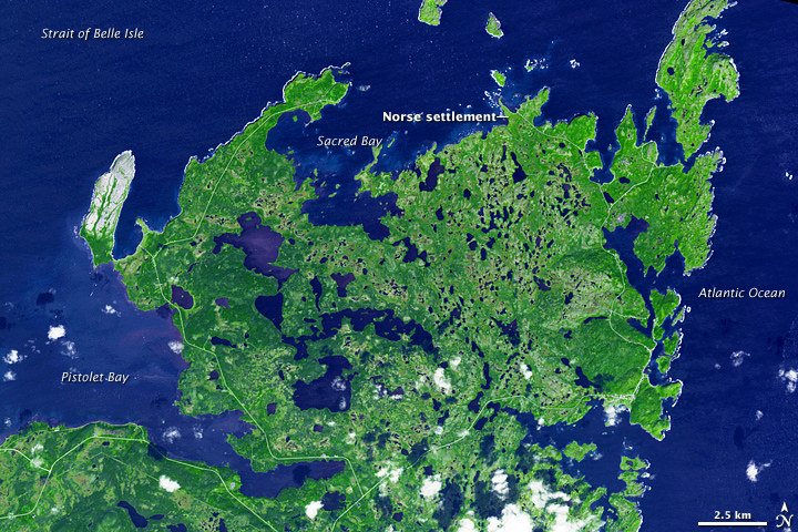
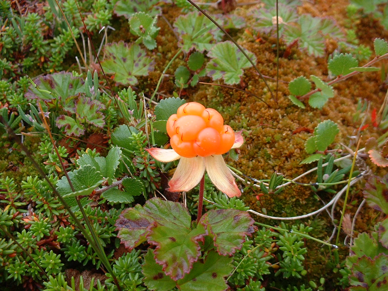
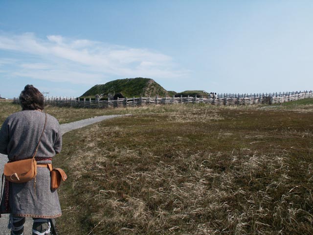
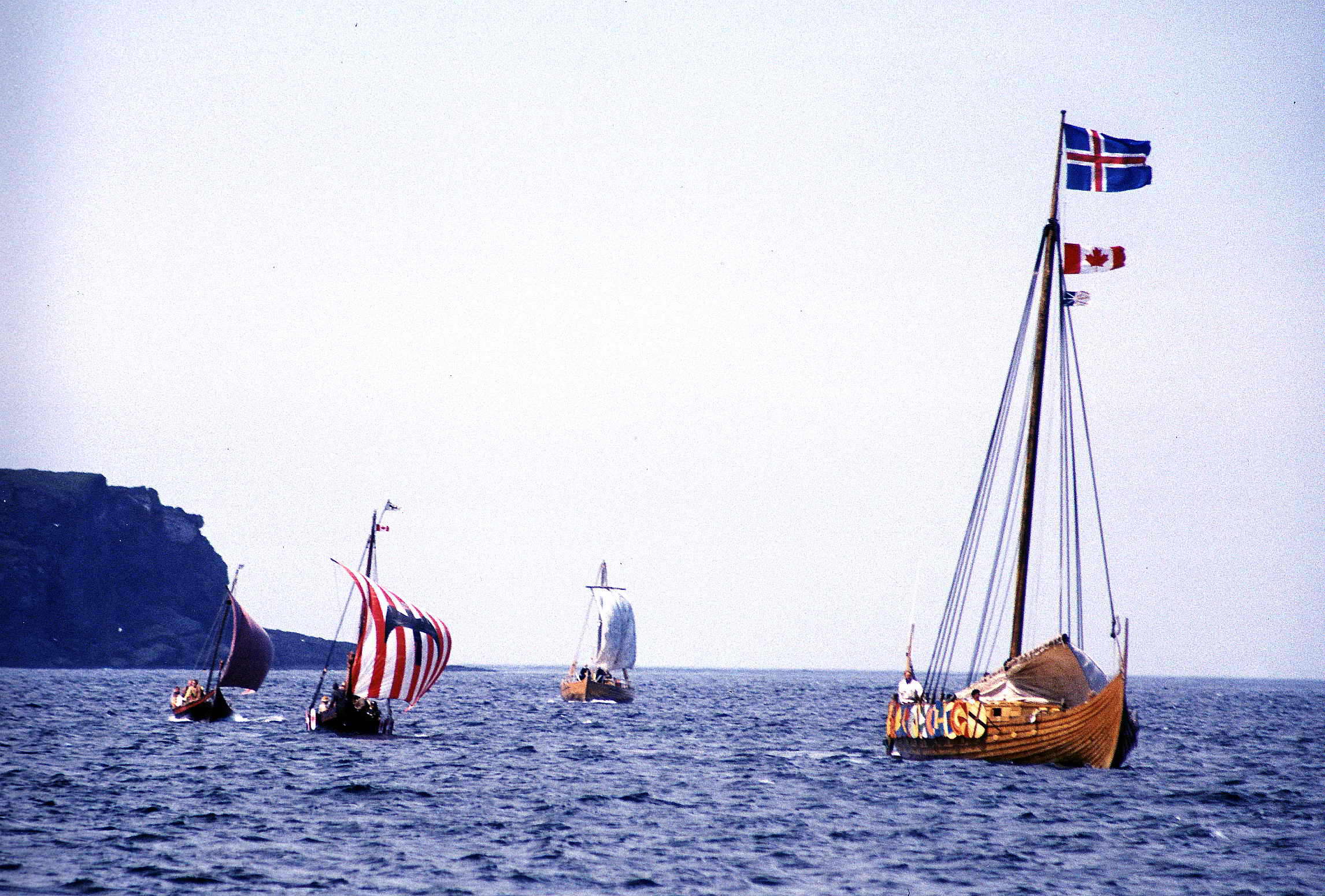